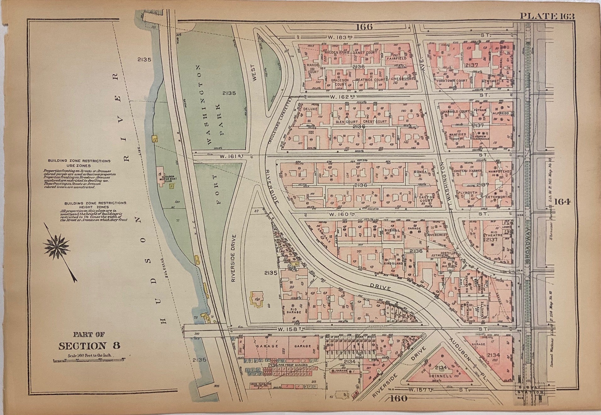
![Item #301369 Plate 163, Part of Section 8 [Washington Heights]. George W. BROMLEY, Walter S. BROMLEY.](https://argosybooks.cdn.bibliopolis.com/pictures/301369.jpg?width=768&height=1000&fit=bounds&auto=webp&v=1626466418)
Plate 163, Part of Section 8 [Washington Heights]
Philadelphia: G.W. Bromley, 1925.
Map. Original Lithograph. 11 1/4" x 16 1/4"
This ward map of Manhattan shows the area from W. 157th Street to W 163nd Street, Riverside Drive to Broadway. On the verso, it depicts from Broadway to Amsterdam. Notably, a wooden structure is visible on Riverside Drive between 160th and 158th Streets. This structure, 857 Riverside Dr., was built in 1851, possibly by John Woodhouse Audubon, son of the famous naturalist. The property was owned by sugar refiner and abolitionist minister Dennis Harris from 1852 to 1854. It was then occupied by Harris' friend and fellow abolitionist Judge John Newhouse and his family through the end of the 19th century, and is believed to have had ties to the Underground Railroad. The house is currently at risk of being demolished by real estate developers as historians and activists fight to designate the home a historical landmark to ensure it's preservation. The house was also featured in acclaimed photographer Berenice Abbot's 1937 book and exhibition "Changing New York".
Ward maps were used by fire insurance companies to determine the potential hazards of particular buildings. Color-coding indicates building materials: pink denotes brick and yellow denotes wood. The map was published in Bromley's 1925 Desk top edition of "Atlas of the City of New York, Borough of Manhattan". It is in very good condition with pleasant original coloring. This fine map shows how much New York City has changed--and hasn't--in the last hundred years.
Language: English
Price: $125.00
Item #301369