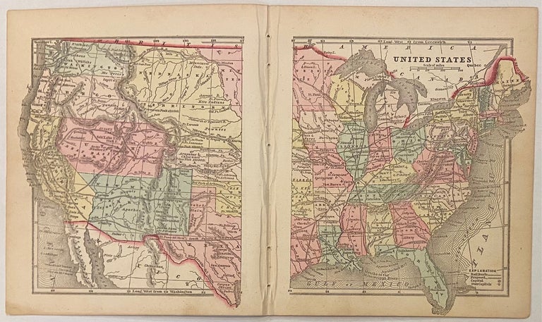
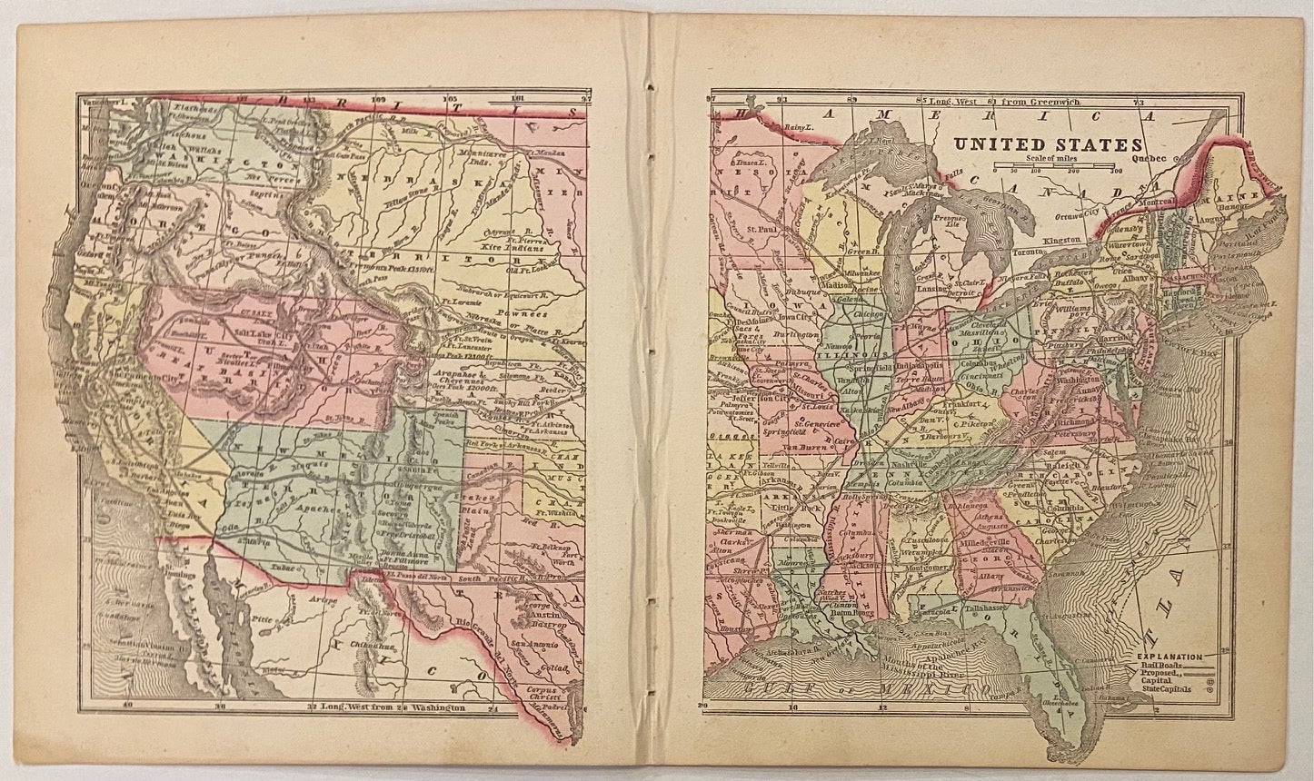
United States
New York: Samuel Gaston, 1857.
Map. Engraving with original hand coloring. Sheet measures 7 1/4" x 12 5/8"
Charming double-page miniature map of the continental United States. Shows waterways, railroads (proposed and existing), and major cities. Relief is depicted by hachure. The map appeared in Colby's "Diamond Atlas" and is in excellent condition.
Charles G. Colby (1830--1866) was an American map-maker active in the mid-19th century who is known best for his miniature maps. His "The World in Miniature," otherwise known at the "Diamond Atlas,"focused on the western hemisphere. His main focus was the United States, and he produced individual maps for each of the states. The atlas also includes maps of the hemispheres, several thematic world maps, North America, Canadian provides, the West Indies, and Central and South America. This map belongs to a vibrant moment in American history.
Binding: Unbound
Language: English
Price: $50.00
Item #301320