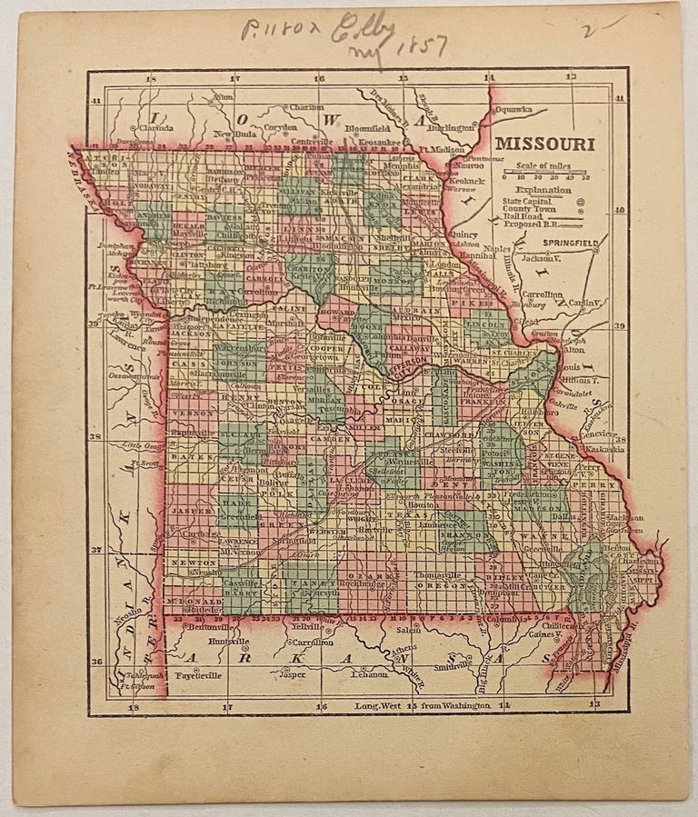
Missouri
New York: Samuel Gaston, 1857.
Map. Engraving with original hand coloring. Image measures 6" x 5 1/2"
This map shows the state of Missouri in the middle of the 19th century. Published in 1857, it belongs to a period of rapid population growth in the state. The map's hand-colored counties and district divisions show how developed the state was becoming. The index includes towns, rivers, and both existing and proposed railroads. The map appeared in Colby's "Diamond Atlas" and is in excellent condition with full margins and no chips or tears. Very slight foxing in left margin not affecting the image. Charles G. Colby (1830--1866) was an American map-maker active in the mid-19th century who is known best for his miniature maps. His "The World in Miniature," otherwise known at the "Diamond Atlas,"focused on the western hemisphere. His main focus was the United States, and he produced individual maps for each of the states. The atlas also includes maps of the hemispheres, several thematic world maps, North America, Canadian provides, the West Indies, and Central and South America. This map belongs to a vibrant moment in American history.
Binding: Unbound
Language: English
Price: $35.00
Item #301305