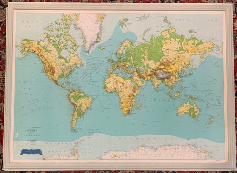
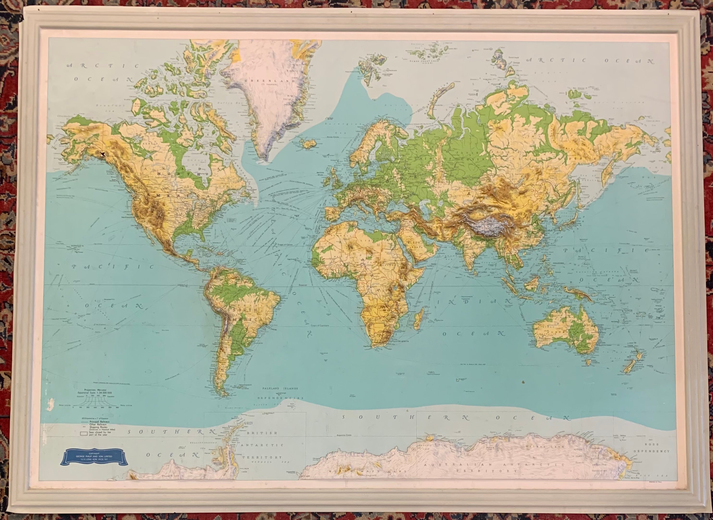
World map
London: George Philip and son Ltd.
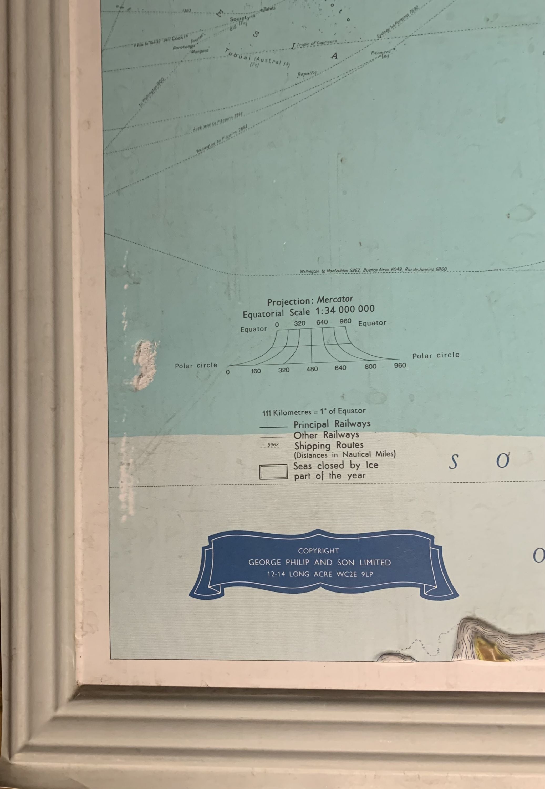
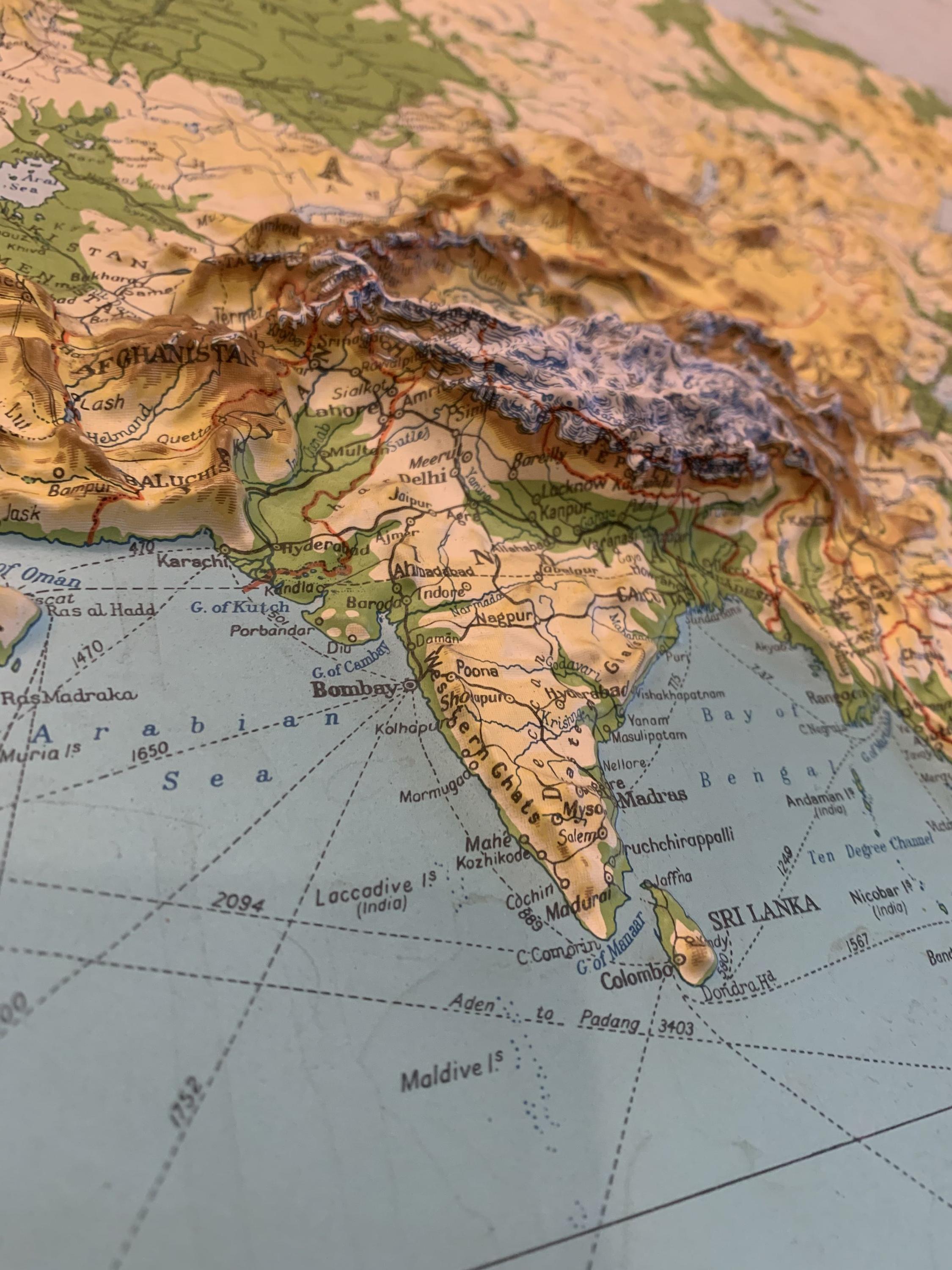
Relief map. 38 1/4 x 51 3/4 inches. Shaded relief on embossed plastic. Five small holes in upper border for hanging directly on the wall. Some scuffs, surface dirt, abrasions and dings and chips to margins. but otherwise ready to hang.
Beautiful large embossed world map on a Mercator projection circa 1975, has molded frame as part of the design. Various shades of cerulean blue in the oceans set off the gorgeous topography. Railways and shipping routes are featured. Some damage/repair to Mount Saint Elias, the second-highest mountain in both Canada and the United States, on the Yukon and Alaska border. George Philip (1800-1882) was a cartographer and map publisher who began working in educational material. His son, also George (1823-1902), joined the successful and expanding firm in 1848. This fine map is an impressive example of their work as map publishers in the Victorian era and continued on for 140 years until it was sold in 1987.
Binding: Unbound
Language: English
Price: $500.00
Item #300664