
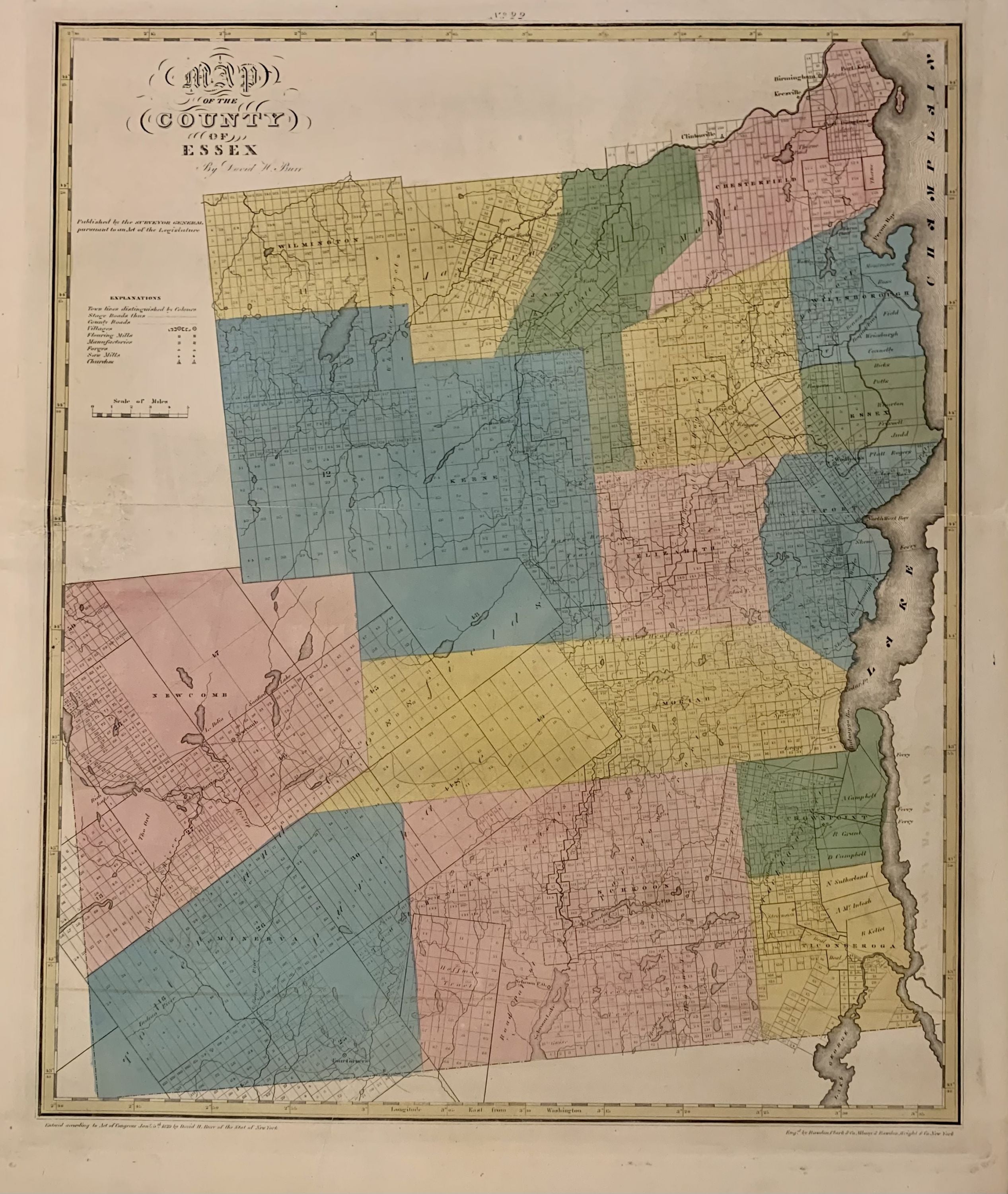
Map of the County of Essex
New York: 1829.
Map. Engraving with original hand outline color. Image measures 22 x 18 1/4 inches. Some chips to margins and repairs to left centerfold but otherwise in good condition.
This 1829 map depicts Essex County in the high peaks region of the Adirondacks, divided into 17 towns in full, vivid color. Lake Champlain forms the right border of the region, and Lake Placid, yet unnamed, appears in the upper left. The map denotes major routes, waterways, and topographical details, and icons label villages, flouring mills, factories, forges, saw mills, and churches. This first edition of Burr's county map appeared in his "Atlas of the State of New York" of the same year, which was the second atlas of an individual state ever published. The map is in good condition with light foxing throughout and some ink stains in the lower right margin, not affecting the image. Full original margins. David H. Burr (1803-1875) served as Topographer to the United States Post Office and Geographer to the House of Representatives and was widely known for his accuracy and attention to detail. His "Universal Atlas" was the first to map each of the United States individually. This map is a lovely rendering of a scenic area in New York State.
Illustrator: Rawdon Clark & Co.
Binding: Unbound
Language: English
Price: $500.00
Item #300575