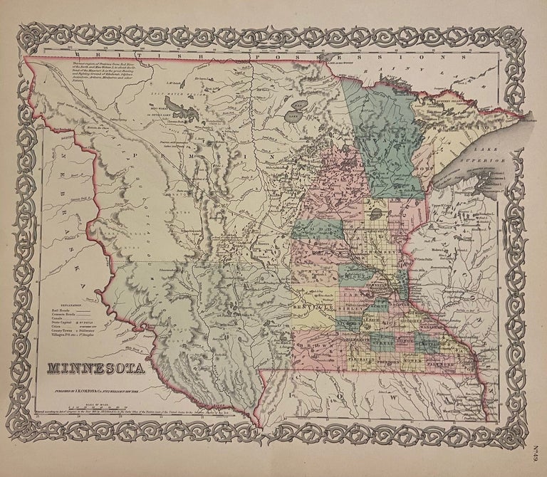
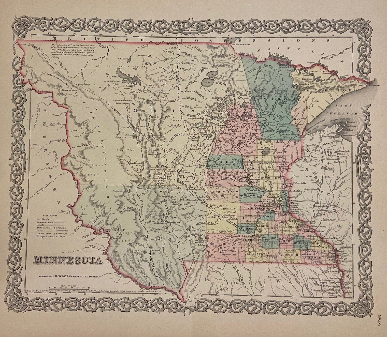
Minnesota
New York: G.W. & C.B. Colton & Co., 1855.
Map. Engraving with original hand coloring. Image measures 11 7/8" x 14 3/4"
Fascinating map of the Minnesota territory published prior to statehood. The eastern part of the state is divided and colored to show county divisions. The western portion, which include parts of present day North and South Dakota, remains unincorporated, and the labels serve to describe the landscape, including topographical features and bodies of water. A notation in the upper margin reads "The vast region of Prairies from Red River of the North and Mini Wakan L. to about the Gr. Bend of the Missouri R. is the great Hunting and Fighting Ground of Kdakotah, Odjibwe, Assiniboin, Arikara, Minitarree and other Nations." Major roads, railroads, waterways, cities, towns, and villages are labeled. Many rivers indicate both native American and English names. Traversing the region is the "Northern Route of Pacific Railroad as Proposed by Gov. Stevens". An interesting and information-dense map of the region at a crucial time in history where it was undergoing significant political and land use change.
The Colton family was one the most prolific and successful publishers of maps and atlases in the United States. J.H. Colton (1800-1893) founded his business in NYC in 1831.
Binding: Unbound
Language: English
Price: $135.00
Item #300200