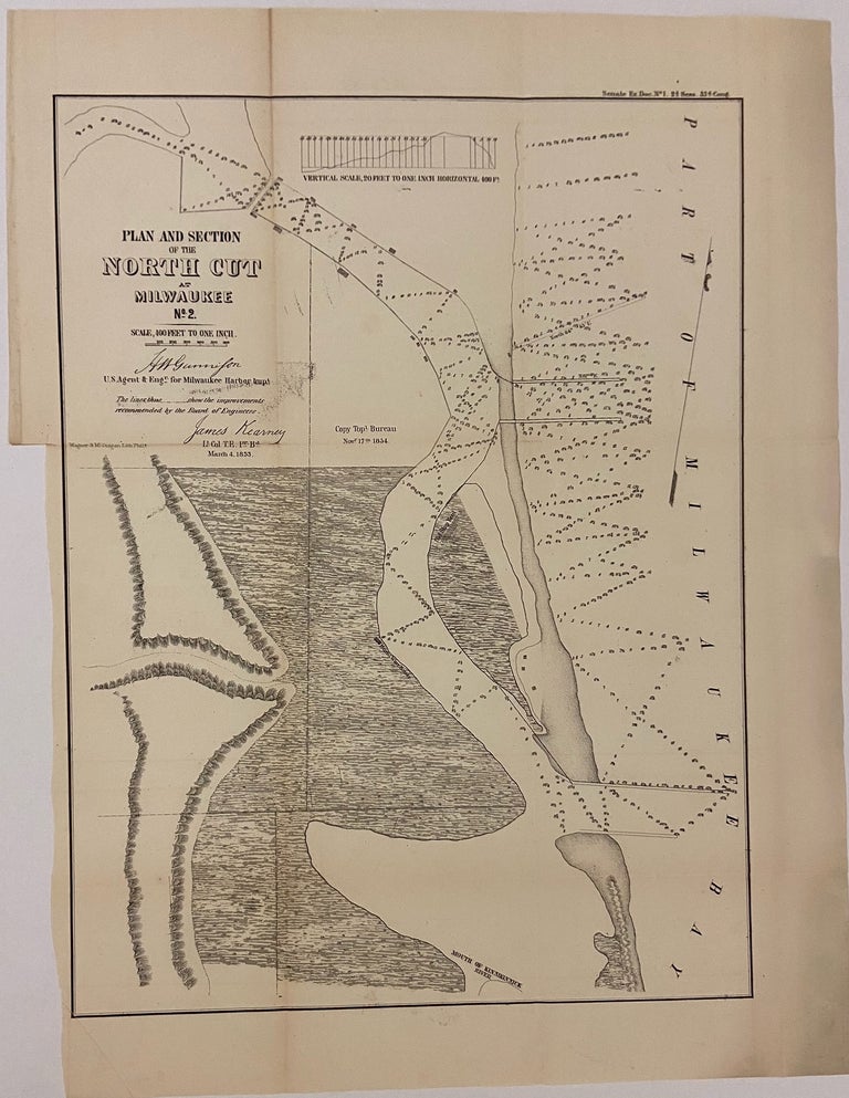
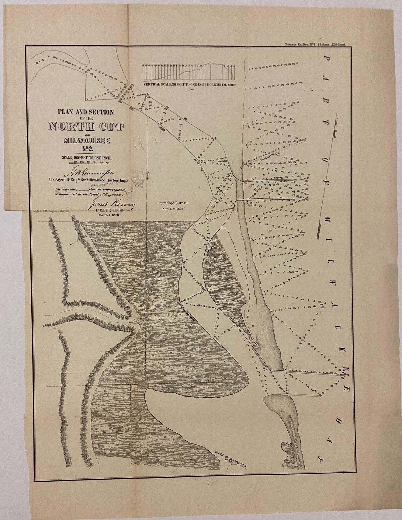
Plan and Section of the North Cut at Milwaukee No. 2
New York: Ackerman Lith. 1853.
Map. Uncolored lithograph. Image measures 117" x 12 3/4"
Nice sea chart of part of the Milwaukee Bay and Kinnikinnick River. Features geographical and topographical details, shipyards, canals, and government buildings. Left margin cropped, minor toning along original folds.
Binding: Unbound
Language: English
Price: $65.00
Item #299854
See all items by J. H. GUNNISON