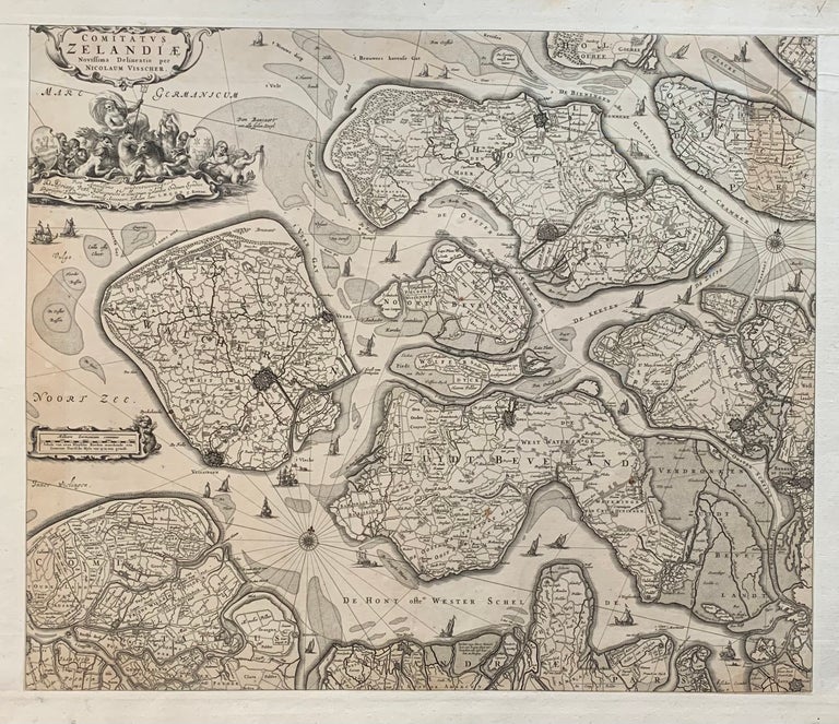
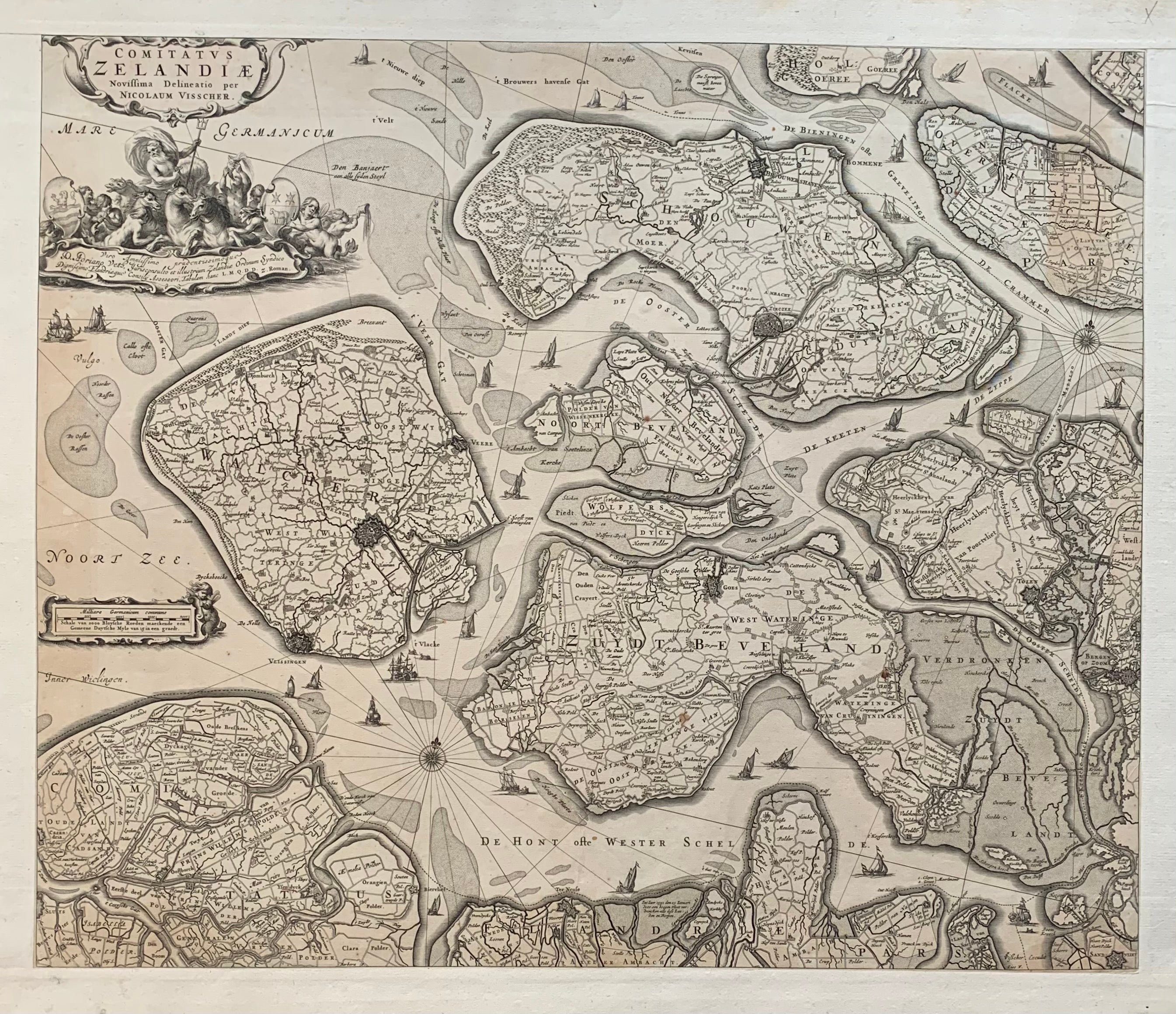
Comitatus Zelandiae Novissima Delineatio
Amsterdam: Nicolaas Visser, 1690.
Map. Engraving with extended publisher margins, and no centerfold. Image measures 18 1/4 x 21 5/8", Sheet measures 20 7/8 x 24 3/4". Page number written in ink upper right margin.
Striking map of Zeeland, the westernmost province of the Netherlands. Showing the islands of Walcheren, Beveland, Schouwen and Tholen within the Scheldt estuary, and Flanders in the south. The map illustrates polders, topography, roads, town and fortified Cities. The title cartouche credits Nicolas Visscher, and the imprint of his father, Claes Janszoon Visscher, is noted in the lower right. Claes Visscher (1587-1652) was the founder of the family business of engravers and publishers based in Amsterdam. Nicolaes I (1618-1679) worked with his Father and continued the business. His son Nicolaes Jansz. II inherited the business with his wife Elizabeth Visscher who ran it on her own after he died for more than 20 years. Hard to find.
Binding: Unbound
Language: Dutch
Price: $550.00
Item #298862