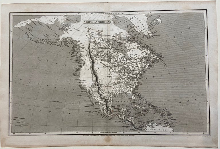
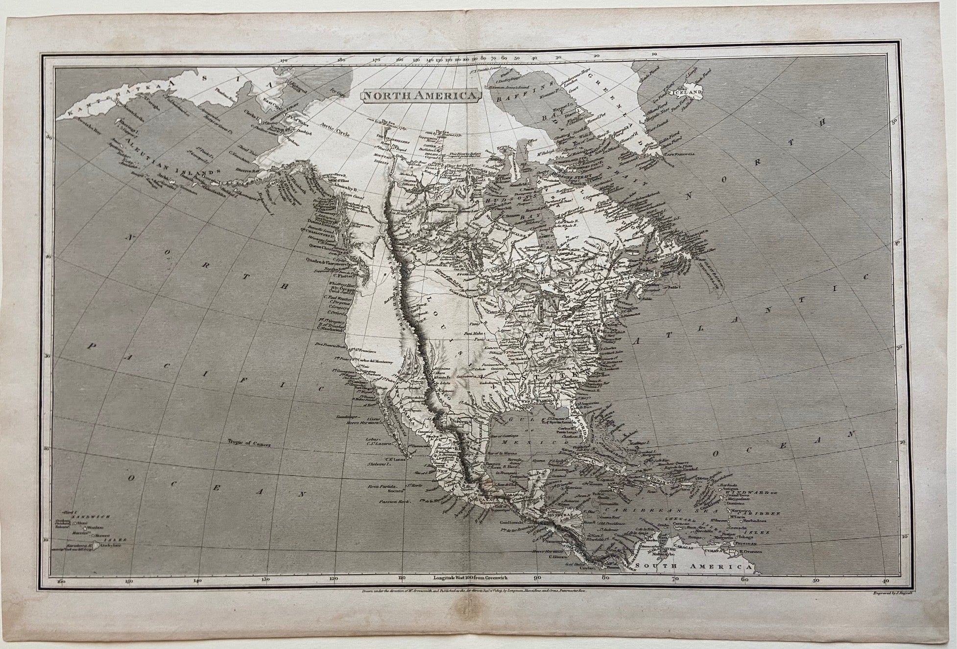
North America
London: Longman, Hurst, Rees & Orne, 1809.
Map. Original uncolored engraving. Sheet measures 11 1/2" x 17 1/8".
This detailed map shows North America. The map includes the Arctic Circle, from Iceland to eastern Asia, extending southward to the Caribbean coast of South America. The Rocky Mountain Range is depicted prominently, drawn as one cordillera extending from Canada and connecting to the Sierra Madre mountains through Mexico and the Cordillera Central in Central America. The combined ranges are labeled "the Stony Mountains". The continent is labeled in great detail, showing cities, isles, bodies of water, mountain ranges and coastal features. The map is in very good condition, with minor foxing and toning to margins.
Aaron Arrowsmith (1750- 1823) was from a family of London based cartographers and publishers. Trained under John Cary and William Faden, he was given the title of "Hydrographer to the Prince of Wales" in 1810 and "Hydrographer to the King" in 1820. The family business was taken over by his sons, and eventually by his nephew, John Arrowsmith, who was a founding member of the Royal Geographical Society.
Illustrator: John Russell
Binding: Unbound
Language: English
Price: $225.00
Item #298695