
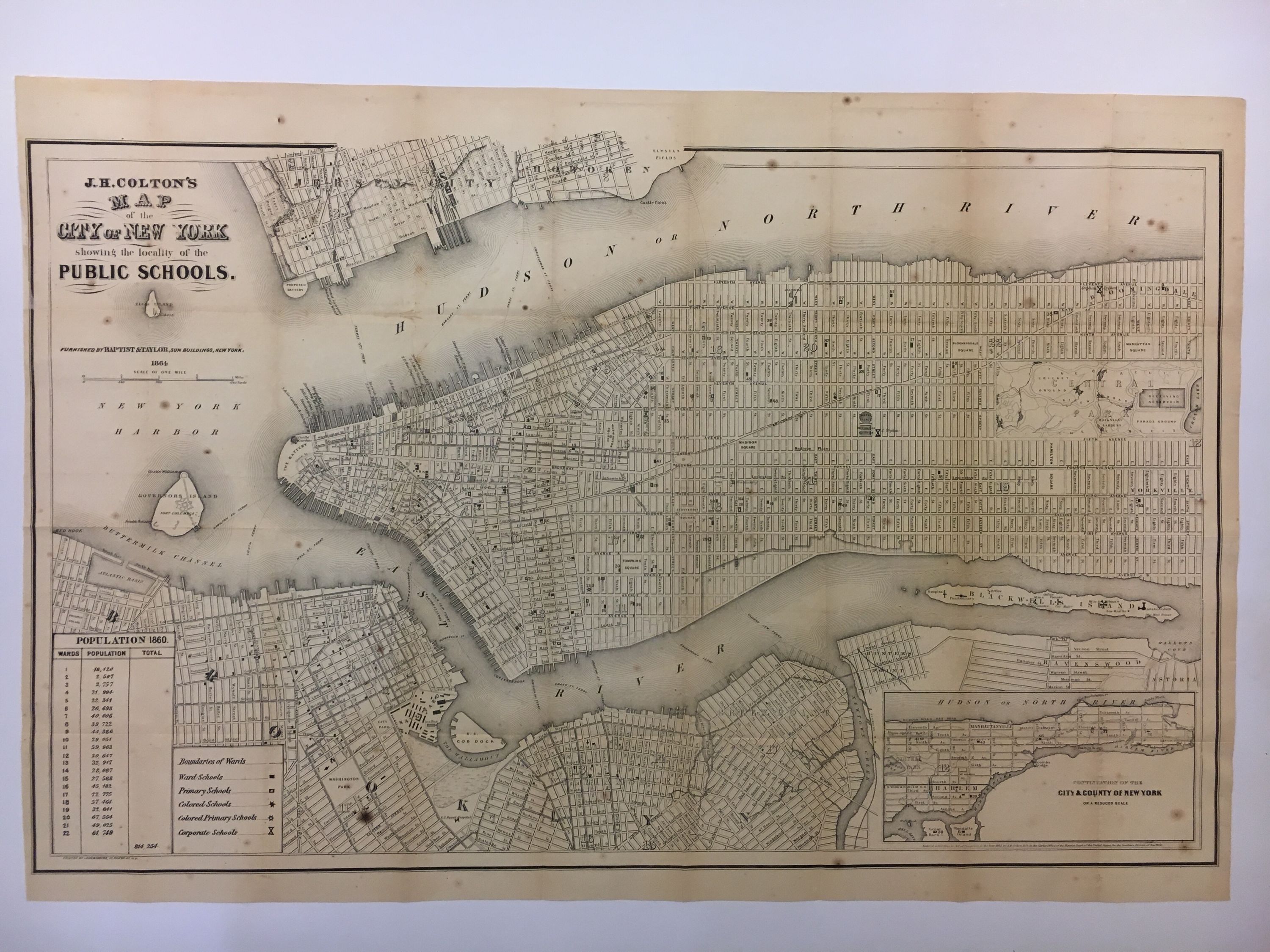
Map of the City of New York Showing the Locality of the Public Schools
New York: Baptist & Taylor, 1864.
Map. Lithograph. Page size 17 1/4" x 25 3/4". Image size 16 1/2" x 25 1/4", some foxing and toning to map with 403pp. 12mo, original brown blind-stamped brown cloth, gold insignia on front cover. New York: Hall of the Board of Education. 1864. Very good(+).
Fascinating 1864 map of Manhattan showing part of Brooklyn, Hunters Point, Ravenswood and Astoria featuring school locations. Includes an inset of upper Manhattan, ward boundaries, five different school types are listed and a population table noting 814 254 inhabitants in the city. There was only one 'colored primary school' at the time the map was printed. The Colton family was one the most prolific and successful publishers of maps and atlases in the United States. J.H. Colton (1800-1893) founded his business in NYC in 1831. Scarce.
Language: English
Price: $1,000.00
Item #298610