
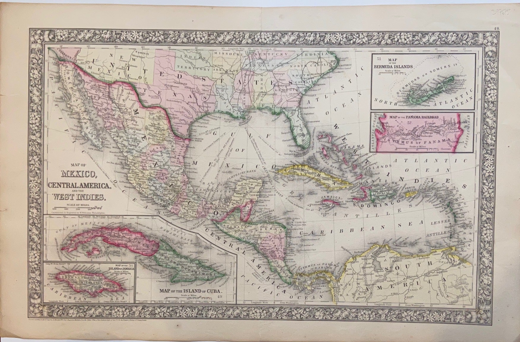
Map of Mexico, Central America, and the West Indies.
Philadelphia: Mitchell, Samuel Augustus Jr., 1866.
Map. Engraving with original hand coloring. Image measures 13.25" x 21".
Beautiful map of Mexico published in 1866. centered on the Gulf of Mexico. Includes four inset maps; Jamaica, Cuba, Bermuda and Panama.
Samuel Augustus Mitchell Sr. (1792-1868) was one of the leaders in American cartography of the 19th century and pioneered the conversion of engraved map plates to more affordable lithographic plates. His son, Samuel Augustus Mitchell Jr. continued his father's successful mapmaking and publishing business, and was one of the most prolific and renowned 19th century American publishers.
Illustrator: W. Williams
Binding: Unbound
Language: English
Price: $175.00
Item #297675