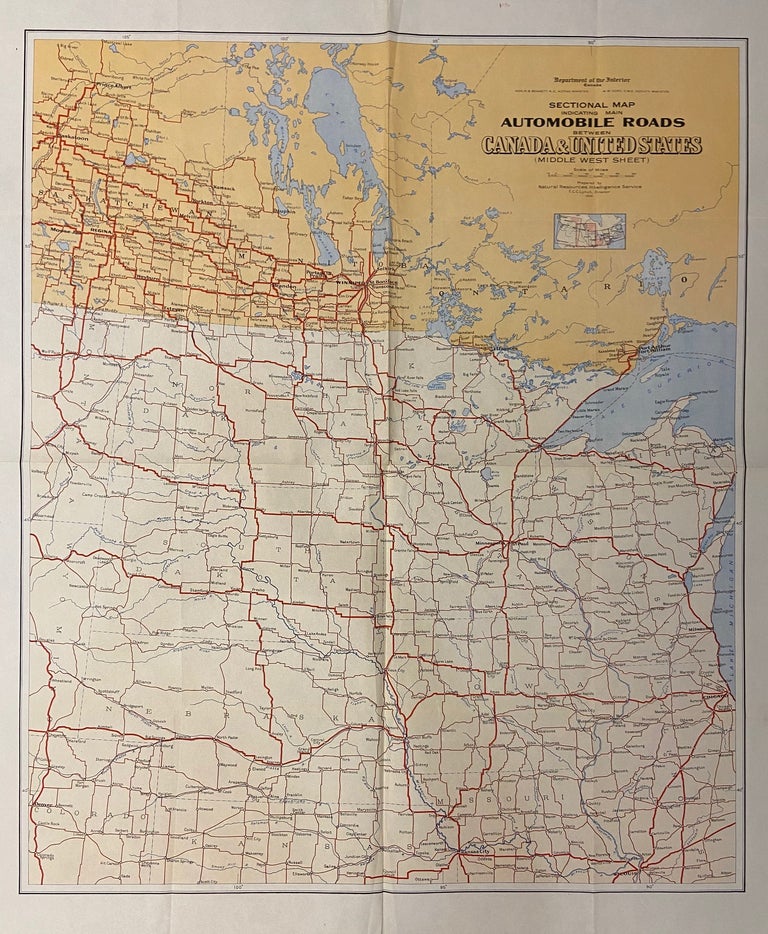
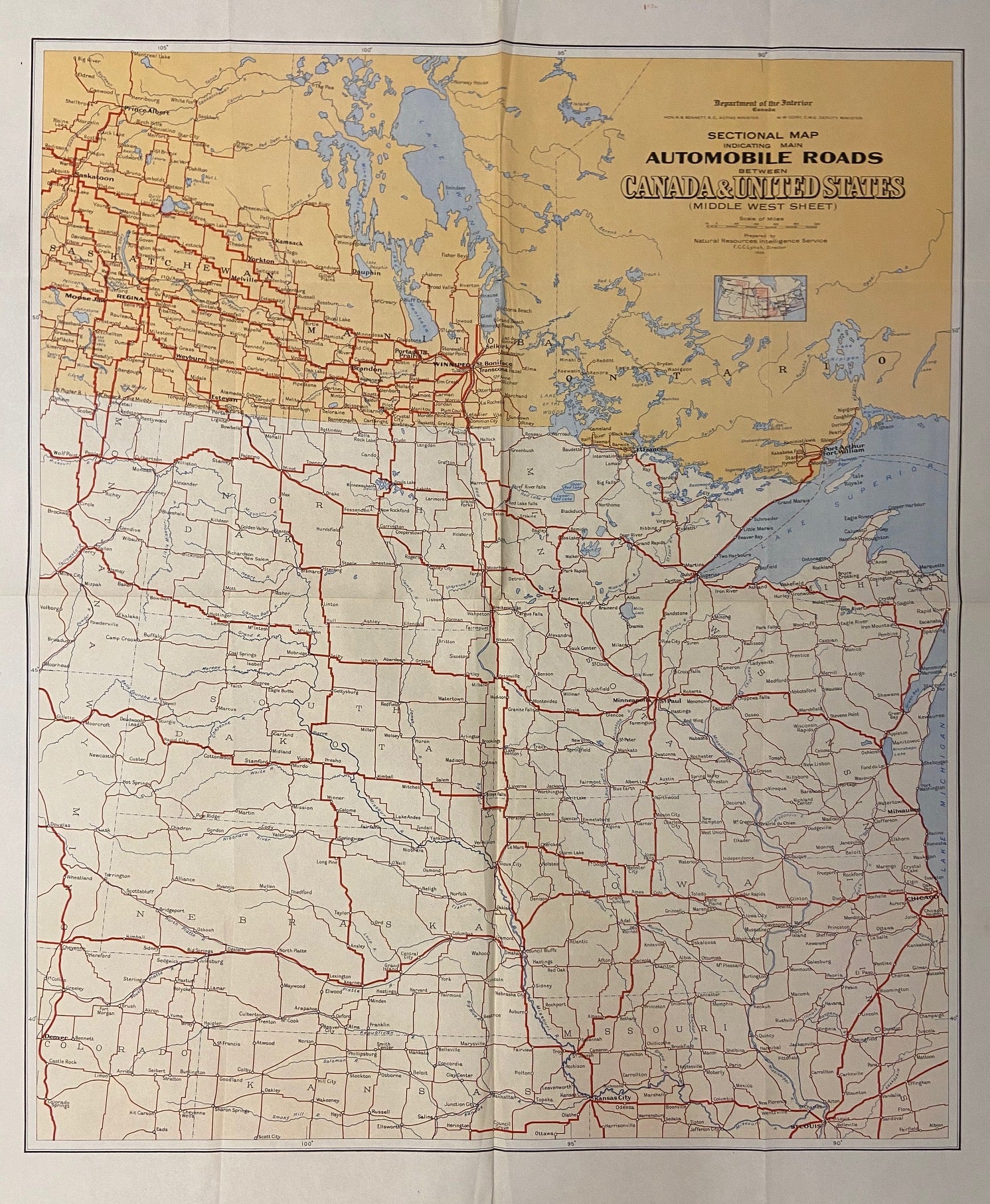
Sectional Map indicating main Automobile Roads between Canada and United States; (Middle West Sheet)
Ottawa: Canada Department of the Interior, 1926.
Map. Sheet measures 42" x 36".
This extensive road map shows all major automobile roads connecting the United States and Canada. Part of a set of 4 maps divided by region, this map is the Middle West Sheet and depicts Saskatchewan, Manitoba, and Ontario; Wisconsin, Minnesota, North and South Dakota, Nebraska, Iowa, Kansas, Missouri, Illinois, and Michigan. It shows state and province boundaries, bodies of water, cities and towns, and national parks. A small inset map is included below the title to show the four sheets that make up the series, and the geographical regions they cover. American Museum of Natural History stamp in upper margin. Folded as issued.
The maps were prepared by the Natural Resources Intelligence Service under Director F.C.C. Lynch. Later editions of this map, published through the 1930s, were issued by National Development Bureau under the same director. The series sought to promote tourism in Canada.
Language: English
Price: $165.00
Item #297609