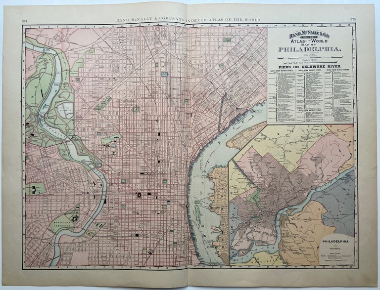
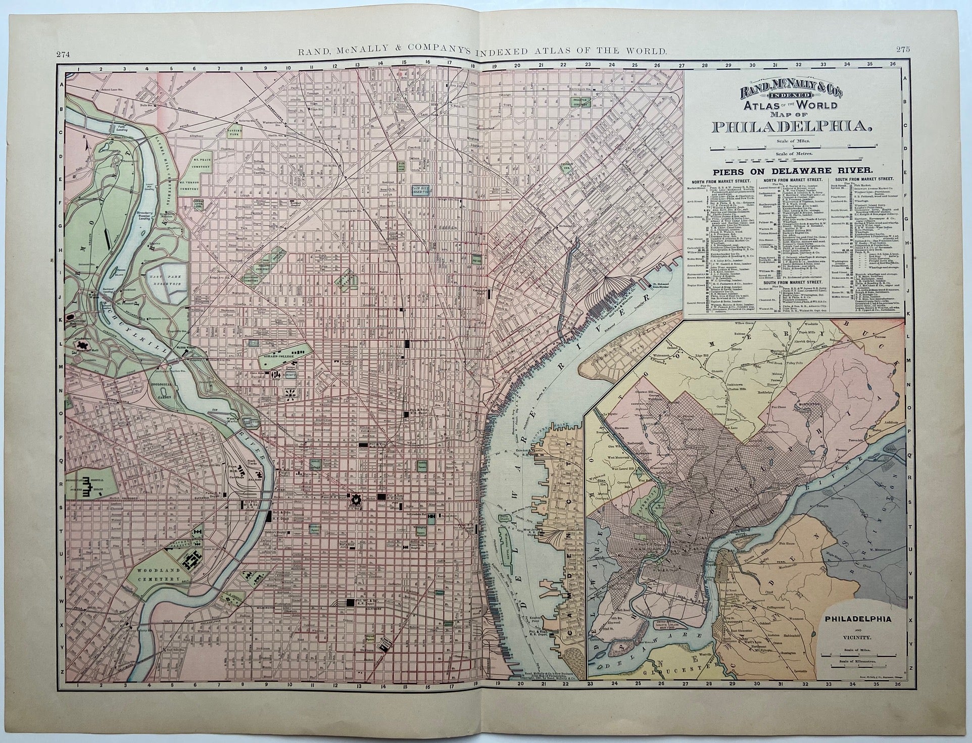
Map of Philadelphia
Chicago: Rand McNally & Co., 1894.
Map. Lithograph. Sheet measures 21 7/8" x 29"
This beautiful 1894 Rand McNally map depicts the city of Philadelphia in vivid color and wonderful detail, extending from Erie Avenue in North Philadelphia, including Fairmount Park and Port Richmond, to Moore Street in South Philadelphia. Map also depicts part of West Philadelphia and includes the waterfront of Camden, NJ. Streets, notable buildings, parks, railroads, and ferry routes are labeled. Piers along the Delaware River are numbered, with a corresponding index included below the title. A large inset of county of Philadelphia and vicinity shows the city grid throughout the county, as well as rivers and railroads extending to bordering counties in Pennsylvania and New Jersey. County boundaries are indicated by hand coloring. The map is in very good condition.
Rand McNally is an American publishing company specializing in maps, atlases and globes. Founded by William Rand in 1856, who hired Andrew McNally in 1858 to work in his shop. The two men formally established Rand McNally & Co. in 1868. The firm remains in business today.
Binding: Unbound
Language: English
Price: $100.00
Item #296644