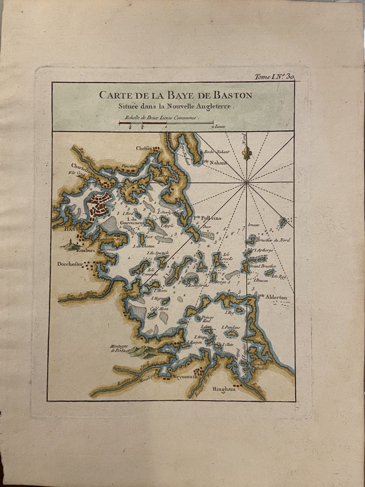
Carte de la Baye de Baston Situee dans la Nouvelle Angleterre
Paris: Jacques Nicolas Bellin, 1764.
Map. Engraving with hand coloring. Page measures 12 1/2" x 9 3/8". Image measures 9"x 7".
Charming early chart of Boston Harbor. Shows depths and sandbars. Very good condition. Jacques Nicolas Bellin (1703-1772), was the official hydrographer to the French king and the first person to hold the title of "Ingénieur de la Marine of the Depot des cartes et plans de la Marine" (chief engineer of the French Hydrographical Office).
Binding: Unbound
Language: English
Price: $350.00
Item #295408
See all items by Jacques Nicolas BELLIN