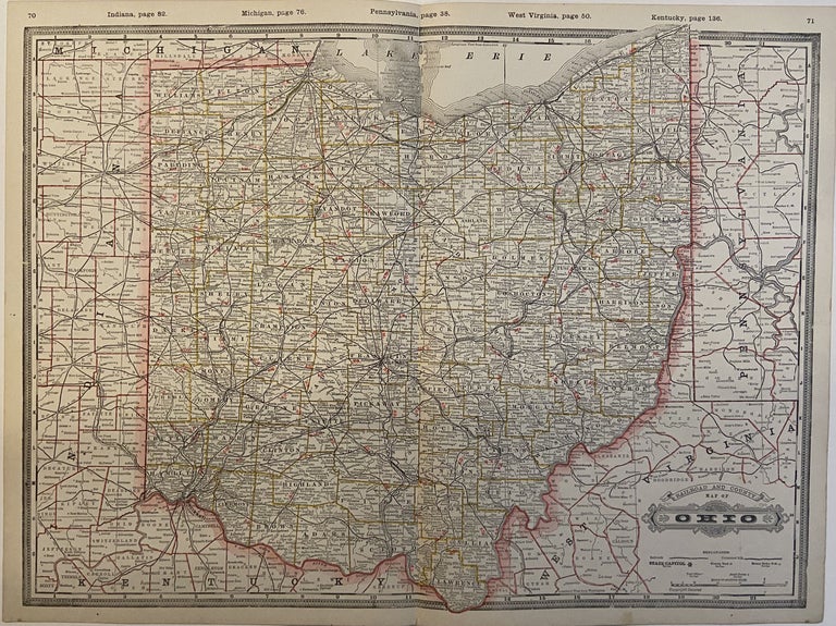
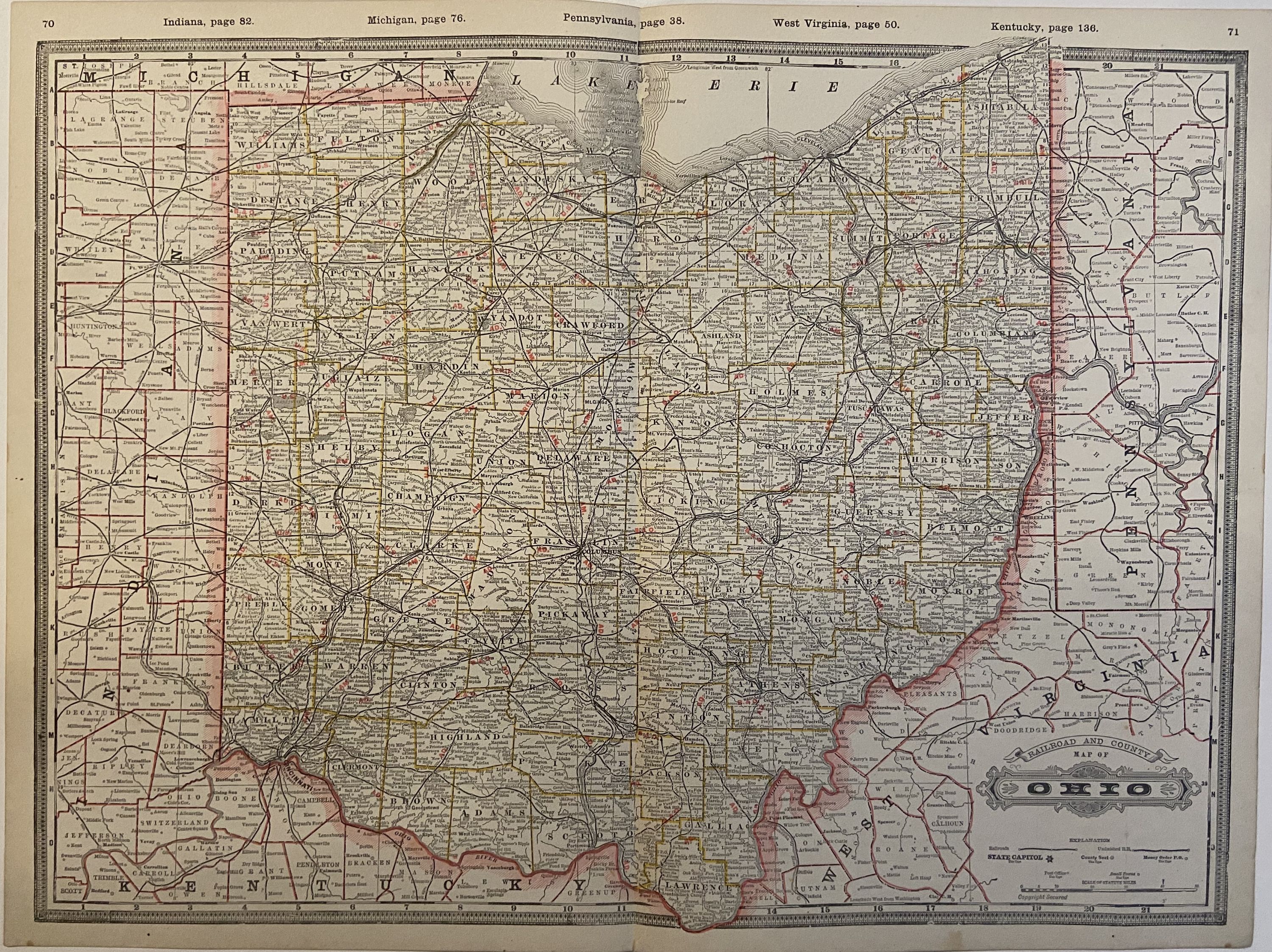
Railroad and County Map of Ohio
Chicago: 1888.
Map. Color lithograph. Image measures 16.75" x 22.55".
Detailed double page map of Ohio divided into counties and townships, showing all major towns and cities, waterways and railroad lines (both finished and unfinished). Provides a fascinating look at transportation in the late 19th century.
After serving in the Union army, George F. Cram (1842-1928) joined his uncle's map business and later established his own engraving and publishing firm in Chicago in 1869. This is an excellent example of his color lithography.
Binding: Unbound
Language: English
Price: $100.00
Item #294403
See all items by George CRAM