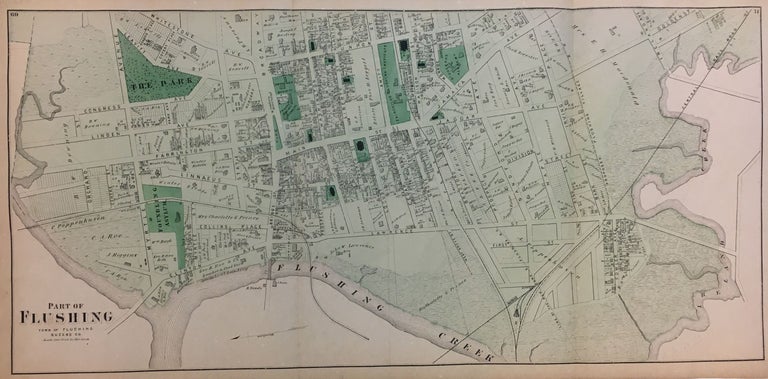
Part of Flushing
1871.
Map. Engraving with original hand coloring. 15 1/2 x 32 1/2 inches.
Detailed map of Flushing in Queens County, New York from Flushing Creek to Ireland Creek. Frederick W. Beers (flourished 1858-1929) came from a family of surveyors, cartographers and publishers originally from Newtown Connecticut. F.W. Beers continued the work of his father James Botsford Beers and was known for his county survey maps of New York, Ohio, Pennsylvania, Michigan, Connecticut and Vermont. Nice visual record of 19th century land ownership in Queens.
Language: English
Price: $200.00
Item #291554
See all items in
LONG ISLAND,
NEW YORK CITY
See all items by Frederick W. BEERS