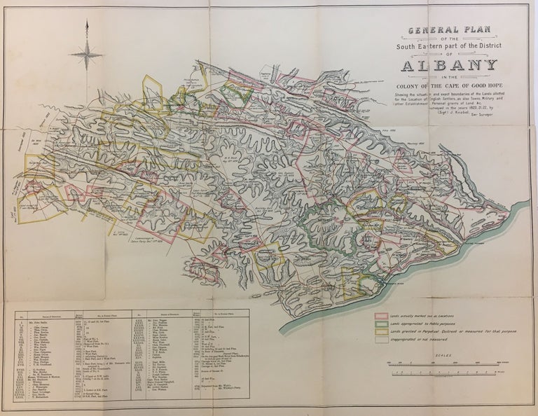
General Plan of the South Eastern part of the District of Albany in the Colony of Good Hope
Morrison & Gibb.
Map. Original color lithograph. Map dissected into 15 segments/folds as issued. 18 x 23.75 inches.
Detailed topographical map featuring the first English wave of settlers to South Africa after they conquered the Cape Colony from the Dutch during the Napoleonic wars. The earliest English settlers were encourage to emigrate from England due to high unemployment established themselves in Albany, pushing out the boundaries of the old Dutch colony and forming a barrier between the original colony and the Xhosa, one of the largest of the native tribes in South Africa after the Zulus. The surveyor Knobel was responsible for laying out plots of land. Boers were forced to immigrate north and this ultimately lead to clashes with the Zulus who were moving south as the Boers moved north, spawning wars both between the Zulus and the Boers and between the Boers and the English. Map show wear along folds. Johann Balthazar Christian Knobel (1781-1853) was a surveyor of Uitenhage, South Africa. Rare.
Language: English
Price: $1,100.00
Item #291054