
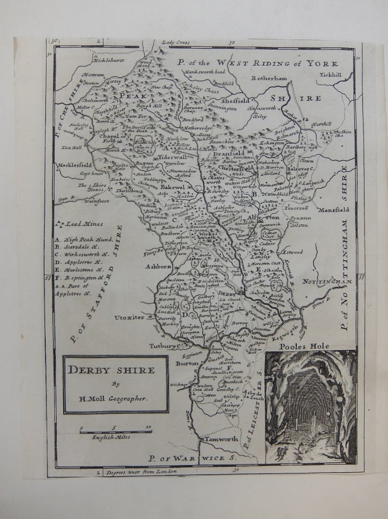
Derby Shire
London.
Map. Uncolored engraving. 10.25" x 8.75". Top and bottom margins trimmed to neat line, otherwise in very good condition.
A map of Derbyshire with a wonderful inset of Poole's Hole (Poole's Cavern). Key indicates the location of lead mines and hamlets within the county. Castles, waterways, roades, forests and mountains are also shown.
Of German or Dutch origin, Herman Moll (c. 1654-1732) settled in London in the 1670's where he worked as an engraver for Moses Pitt. By the turn of the century, Moll became the foremost map publisher in England, where he produced Atlases and maps. As an engraver, cartographer, mapseller and globemaker he appealed to the public with his unusual views and vignettes. As the demand for his work was sustained, he issued many revised editions of his work.
Binding: Unbound
Condition: Very Good
Language: English
Price: $100.00
Item #288898