
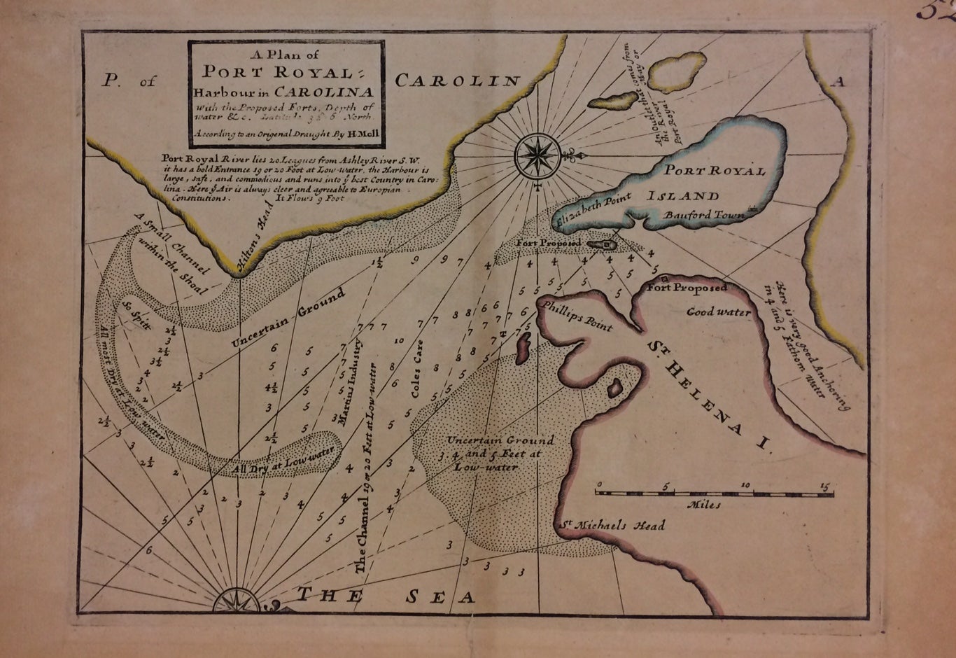
A Plan of Port Royal Harbour in Carolina with the Proposed Forts, Depth of Water &c.
Map. Engraving with original hand coloring. 9.5" x 13.75". In very good condition.
A map of Port Royal Harbor, South Carolina. Text reads: "Port Royal River lies 20 Leagues from Ashley River S.W. it has a bold Entrance 19 or 20 foot at Low-water. The Harbour is large, safe, and commodious and runs into the best Country in Carolina. Here ye Air is always clear and agreeable to Europian Constitutions." Both Hilton Head and Beaufort and indicated.
Of German or Dutch origin, Herman Moll (c. 1654-1732) settled in London in the 1670's where he worked as an engraver for Moses Pitt. By the turn of the century, Moll became the foremost map publisher in England, where he produced Atlases and maps. As an engraver, cartographer, mapseller and globemaker he appealed to the public with his unusual views and vignettes. As the demand for his work was sustained, he issued many revised editions of his work.
Binding: Unbound
Condition: Very Good
Language: English
Price: $450.00
Item #288350