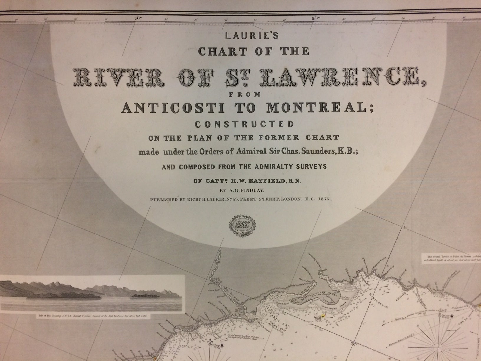
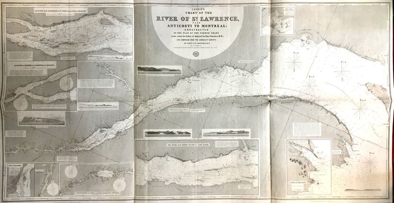
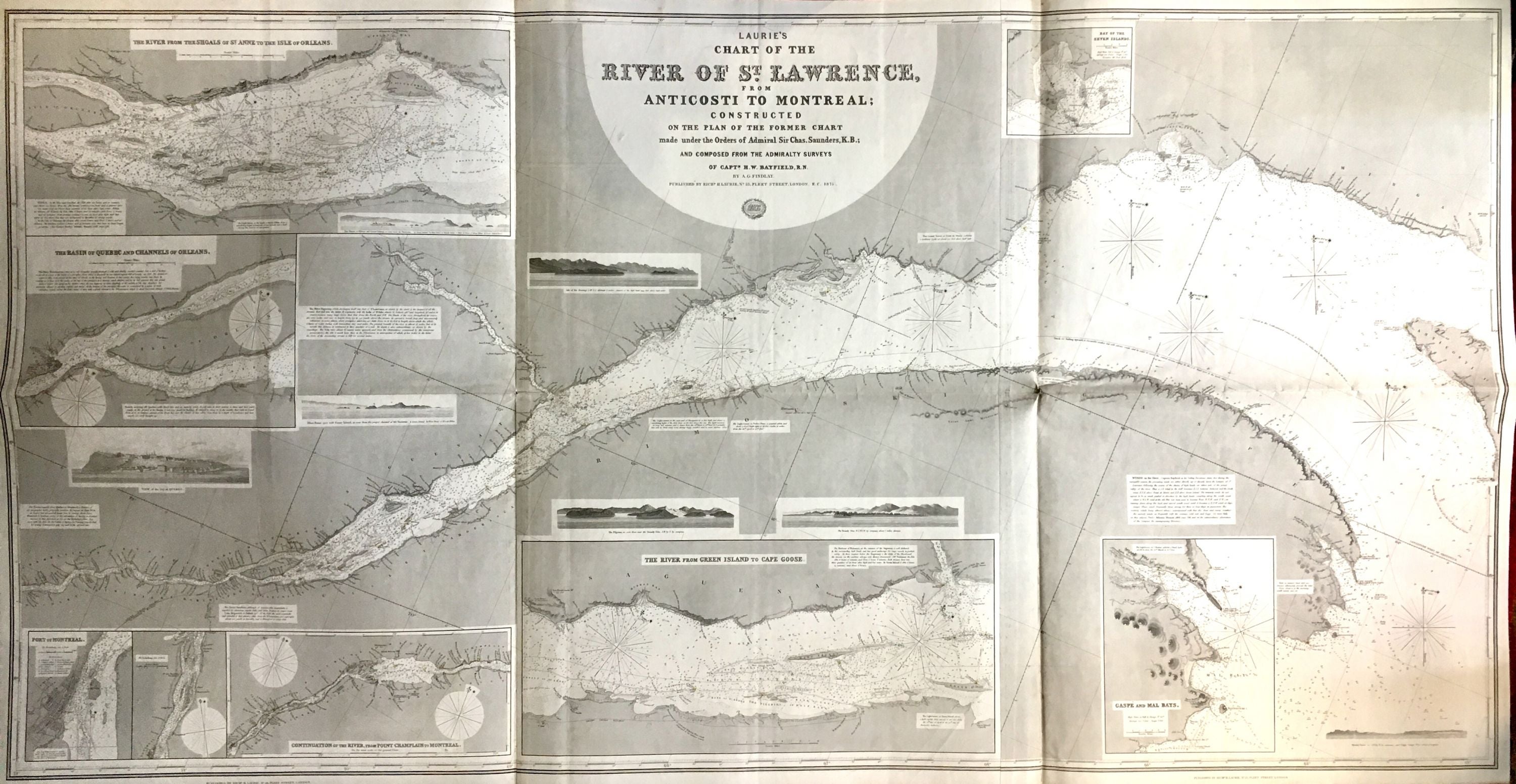
Laurie's Chart of the River St. Lawrence; From Anticosti to Montreal; Constructed on the Plan of the Former Chart
London: Richard H. Laurie, 1875.
Map. Lithograph with hand coloring, mounted to blue paper. 38.75" x 74.5", folds to 19.25" x 25". Shows some light staining along original fold lines, and 1" repair at bottom right fold line. In very good condition.
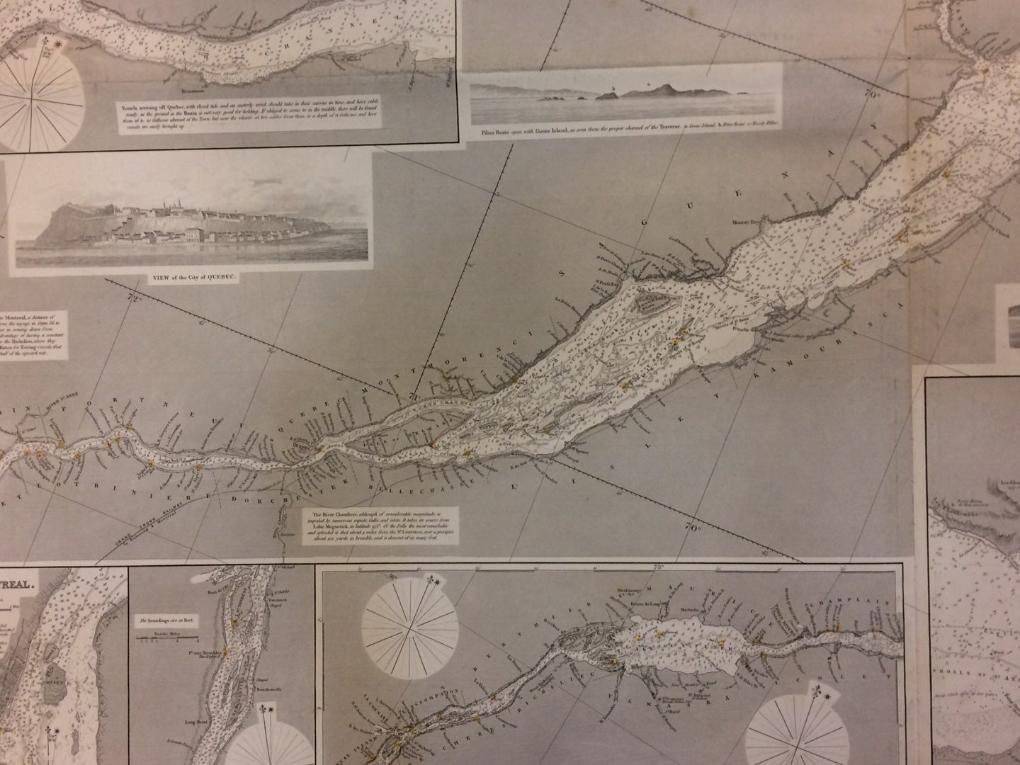
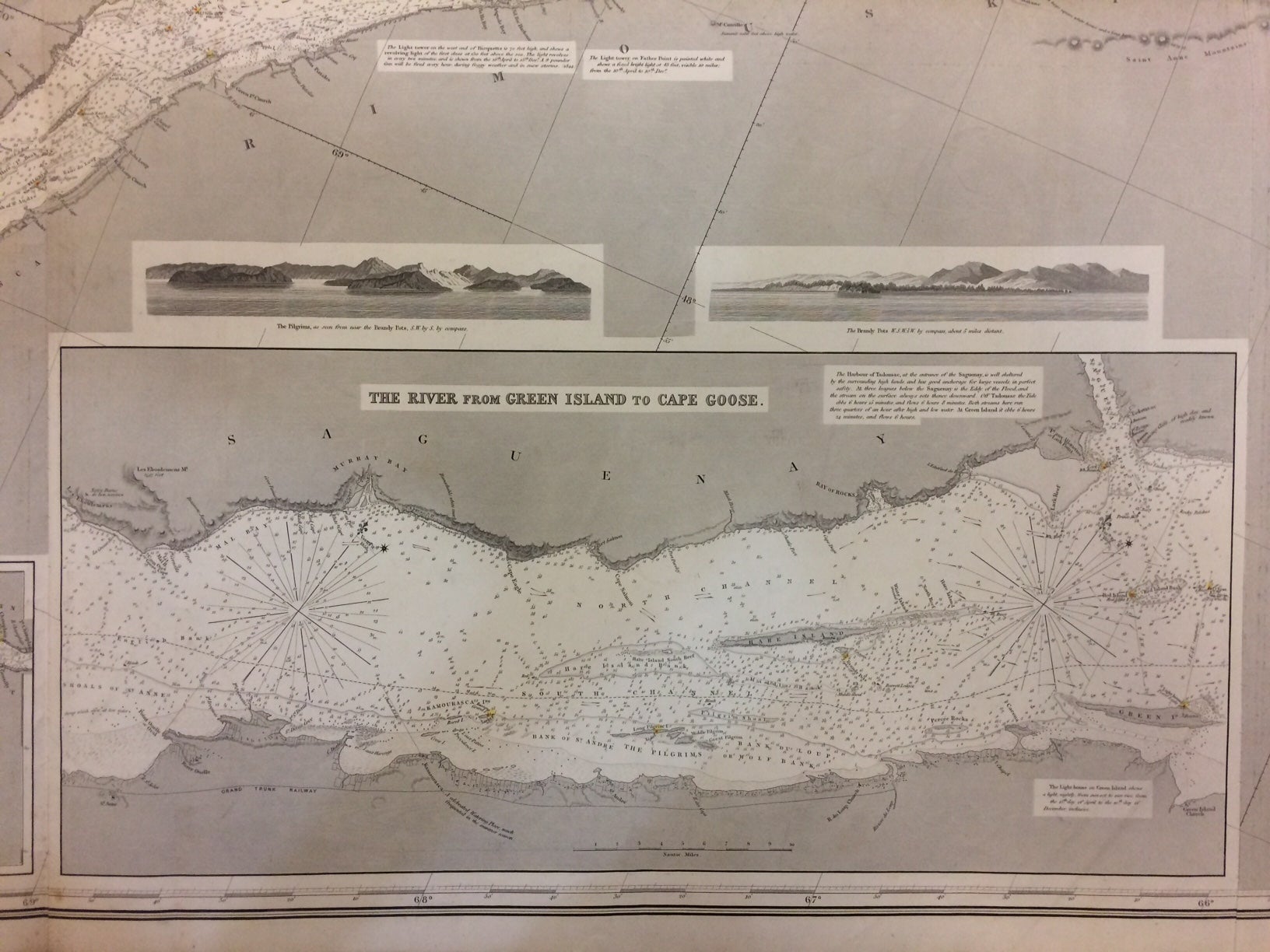
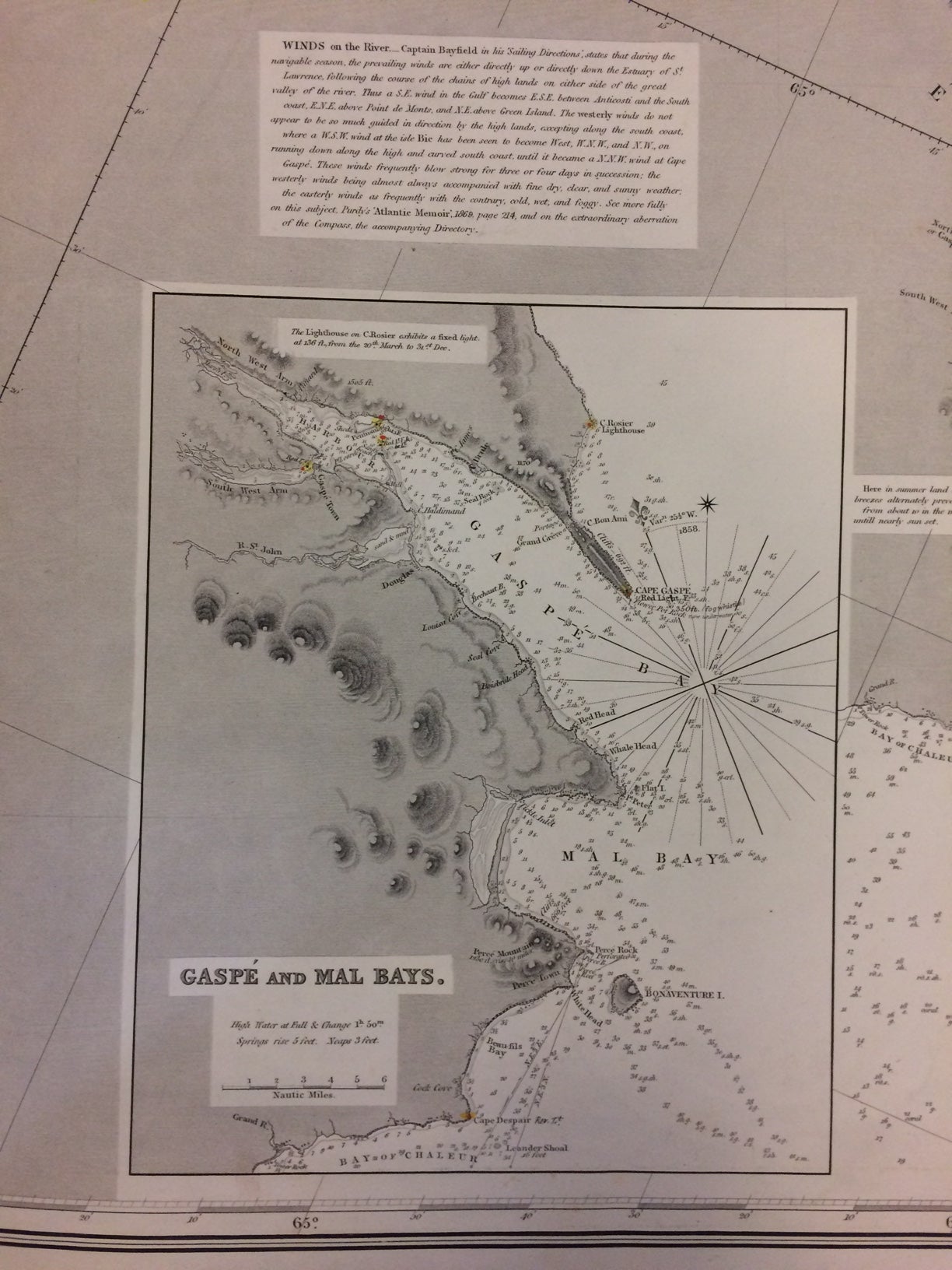
Oversize blue back sea chart made under the orders of Admiral Sir Charles Saunders, K.B.; and composed from the Admiralty surveys of Captain H. W. Bayfield, R.N. Ten insets show the River from the Shoals of St. Anne to the Isle of Orleans, the Basin of Quebec and Channels of Orleans, the Port of Montreal, the Continuation of the River from Point Champlain to Montreal, the River from Green Island to Cape Goose, Gaspe and Mal Bays, and the Bay of Seven Islands. The map also shows views of various locations and channels, soundings and currents, lighthouses, navigational notes, and the River Saguenay.
Richard Holmes Laurie (1777-1858), son of Robert Laurie of Laurie & Whittle, was a British publisher. He became a partner with Laurie & Whittle in 1812, and under his leadership the firm became known for producing fine nautical charts. The imprint R.H. Laurie continued after his death under the guidance of Alexander Findlay.
Binding: Unbound
Condition: Very Good(+)
Language: English
Price: $1,100.00
Item #288120