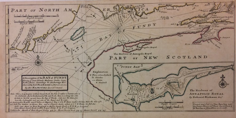
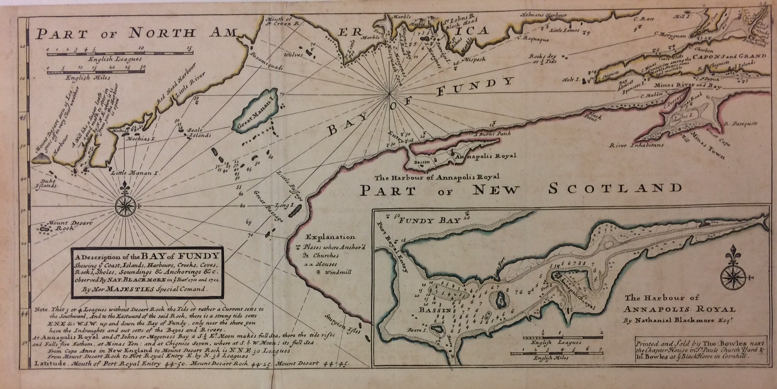
A Description of the Bay of Fundy Shewing ye Coast, Islands, Harbours, Creeks, Coves, Rocks, Sholes, Soundings & Anchorings &c.
London: Thomas Bowles.
Map. Engraving with original hand coloring. 9" x 18". Shows verso repair along one of two original fold lines, otherwise in very good condition.
Beautiful 1736 chart of the Bay. Includes notes on soundings, tides and currents, and an inset of The Harbour of Annapolis Royal. King James I of England named the same territory New Scotland (or Nova Scotia, as it was called in its Latin charter) and granted the land to the Scottish colonizer Sir William Alexander. In the 1620s, the Scots established two settlements, but both were unsuccessful. The Bay of Fundy is the worlds highest tide.
Herman Moll (c. 1654-1732) settled in London in the 1670's where he worked as an engraver for Moses Pitt. By the turn of the century, Moll became the foremost map publisher in England, where he produced Atlases and maps. As an engraver, cartographer, mapseller and globemaker he appealed to the public with his unusual views and vignettes. As the demand for his work was sustained, he issued many revised editions of his work.
Binding: Unbound
Condition: Very Good(+)
Language: English
Price: $500.00
Item #288099