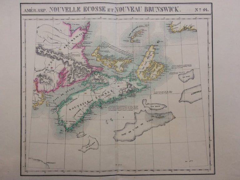
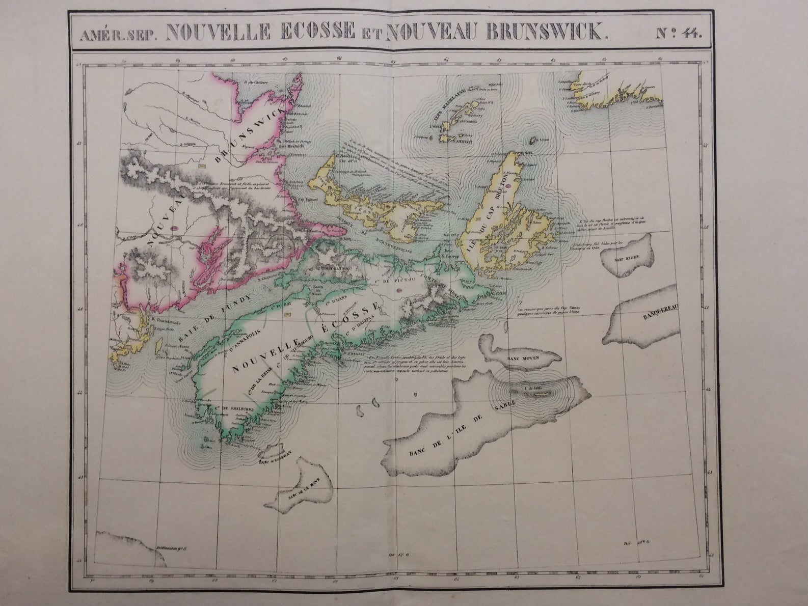
Nouvelle Ecosse et Nouveau Brunswick
Brussels: Vandermaelen, Phillipe Marie, 1827.
Map. Large format lithograph with original hand color wash. Image measures 18.25 x 20.75". Sheet measures 21.25 x 27.5".
This scarce 1827 map of Nova Scotia and New Brunswick is one of the most detailed maps of the region published in the first half of the 19th century. It extends to Prince Edward Island, St. John, Cape Breton, the Madelaine Islands, and the Sable Islands. Topographical features of landforms, water bodies, and fishing banks are labeled in addition to geographical features such as ports, counties, towns, and cities. As was typical of his cartographic style, Vandermaelen has included notations throughout the map that describe the region. The map appeared in Vandermaelen's "Atlas Universal." The map is in excellent condition, a dark impression on bright, clean paper. Deluxe margins with no chips or tears, minor wear to corners not affecting the image. Phillippe Marie Vandermaelen (1795-1869) was a Belgian cartographer and publisher. His Atlas universal was both the first lithograph atlas and the first atlas to map the world on a uniform scale. The maps were meant to join together to form a huge globe. This map is a fine example of his work.
Binding: Unbound
Language: English
Price: $350.00
Item #288092