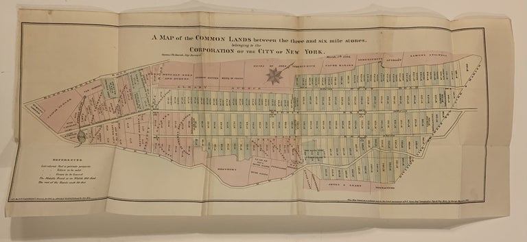
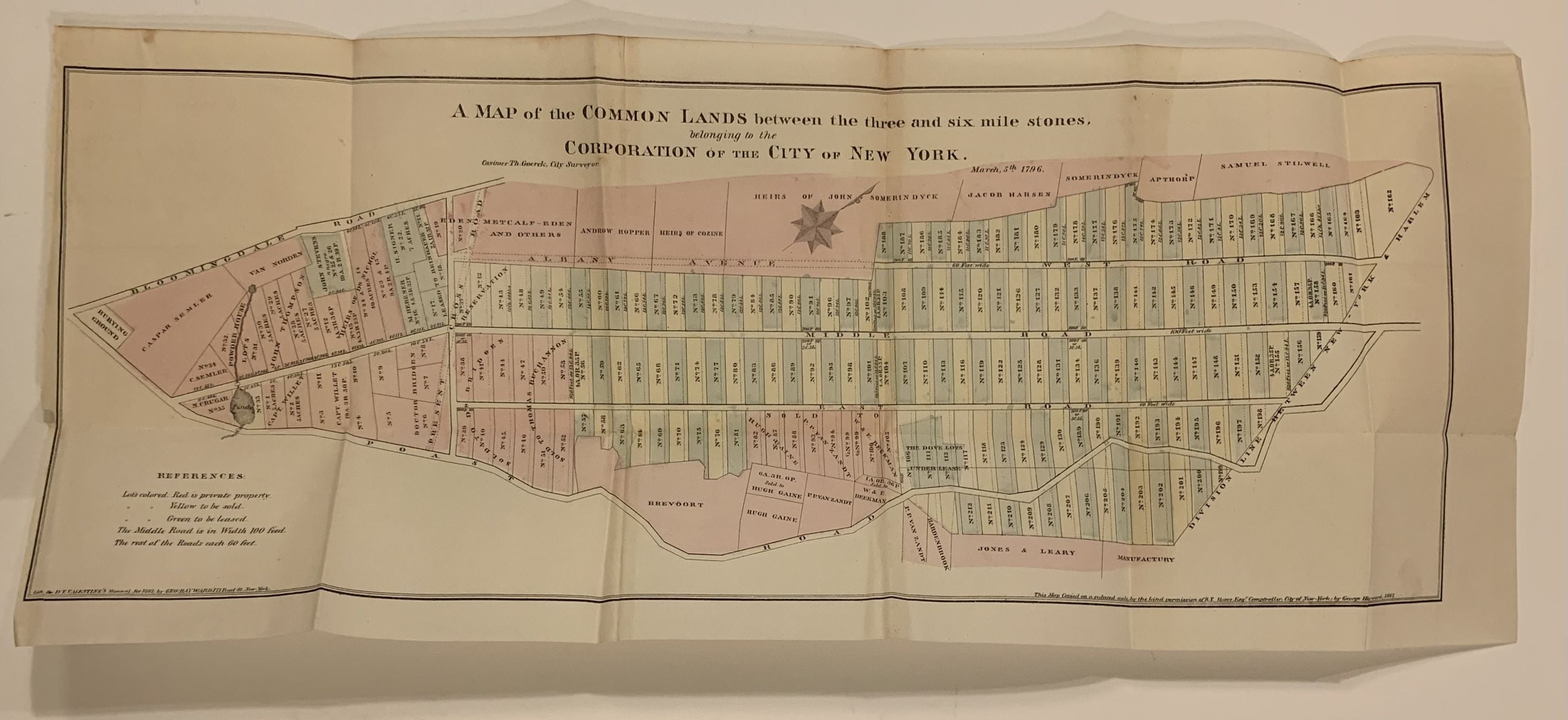
A Map of the Common Lands between the three and six mile stones, belonging to the Corporation of the City of New York
New York: D.T. Valentine, 1861.
Map. Lithograph. Sheet measures 8" x 20".
Cadastral map of central Manhattan after Casimir Goerck's 1796 surveyor map. Starting where Broadway and 5th Avenue intersect (todays Madison Square), it shows an area from 23rd to 93rd Street (the middle of the reservoir in Central Park) with proposed 5 acre lots. Through the colonial period, these rocky hilly lands were ignored. Goerck was hired to survey the area but access to the lots was limited and the project never took off. This edition was lithographed by G.Hayward in the 1861 edition of Valentine's "Manual of the Corporation of New York".
David Thomas Valentine (1801-1869) served as the Deputy to the Clerk of the Common Council for thirty-seven years and began publishing the "Manual for the Corporation of the City of New York" in 1841. The Manuals were directories of extensive historical and contemporary records of New York that included facts about the City of New York, city history, city council information, and reported on the progress of public works such as Central Park. Popularly called Valentine's Manuals, the texts were richly illustrated with maps, lithographs, and engravings. Casimir Theodor Goerck was born in Poland (date unknown) he served as an artillery officer for the Americans during the Revolution. He was an official city surveyor. This is a good example of his unusual designs.
Binding: Unbound
Condition: Very Good(+)
Language: English
Price: $375.00
Item #287742