
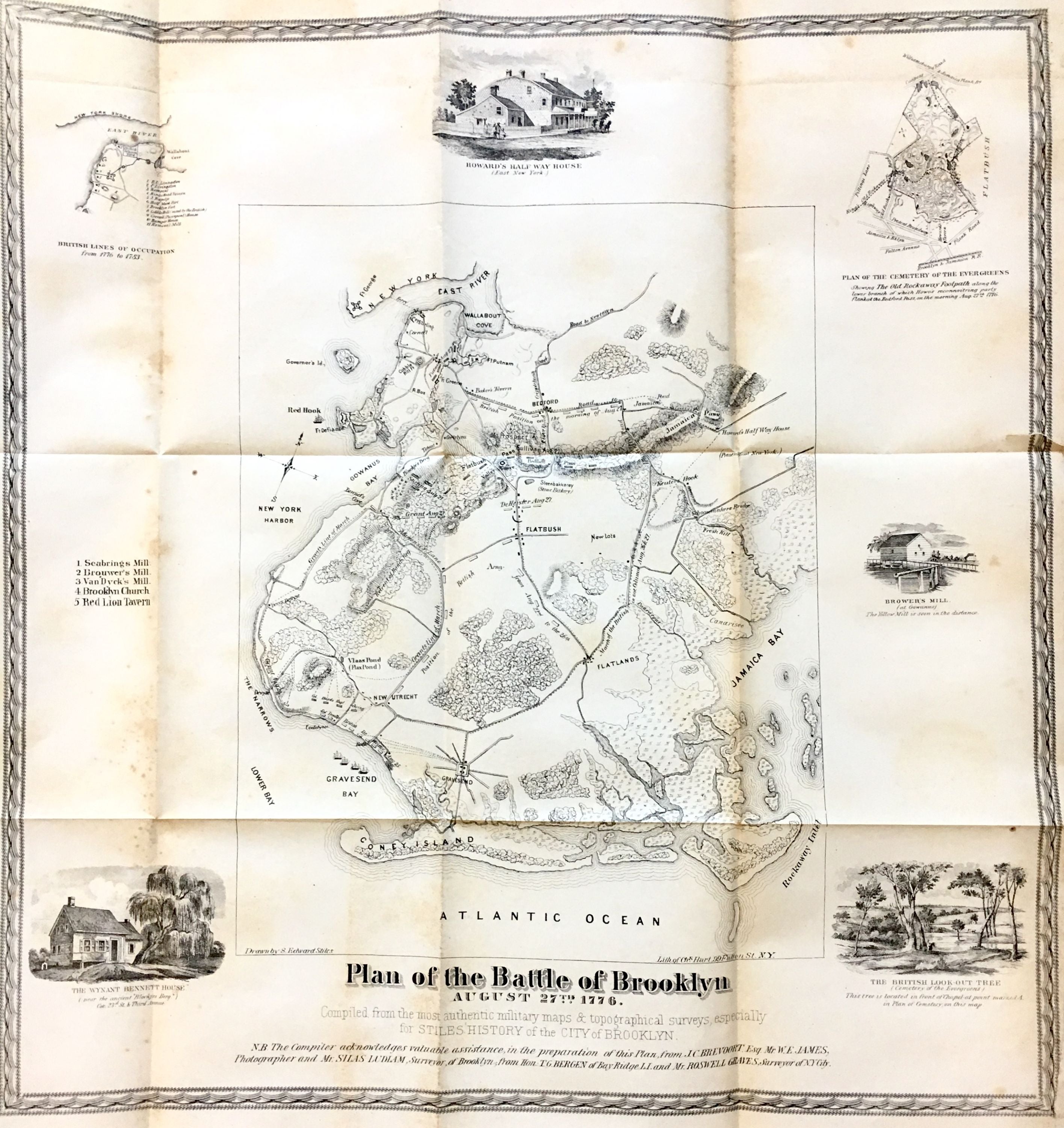
Plan of the Battle of Brooklyn, August 27th, 1776; Compiled from the most authentic military maps & topographical surveys, especially for Stiles' History of the City of Brooklyn
New York: Henry R. Stiles, 1867.
Map. Lithograph. 18 1/2" x 18".
Rare map of Brooklyn showing the Battle of Brooklyn in 1776. Published in Henry R. Stiles' History of the City of Brooklyn in 1867 and drawn by his brother, Samuel Edward Stiles. Shows the locations of forts and roads in Brooklyn from what is now Brooklyn Heights to Coney Island and the Atlantic Ocean. The map is surrounded by 4 views, They Wynant Bennett House, the British Look-Out Tree, Brower's Mill, and Howard's Half-Way House, and 2 smaller maps, Plan of the Cemetery of the Evergreens, and British Lines of Occupation. Very intricate. Hard to find.
Binding: Unbound
Condition: Very Good(+)
Language: English
Price: $750.00
Item #287618