Berlin
Presse- und Informationsamt Berlin.
Map. Offset lithograph. 24" x 33".
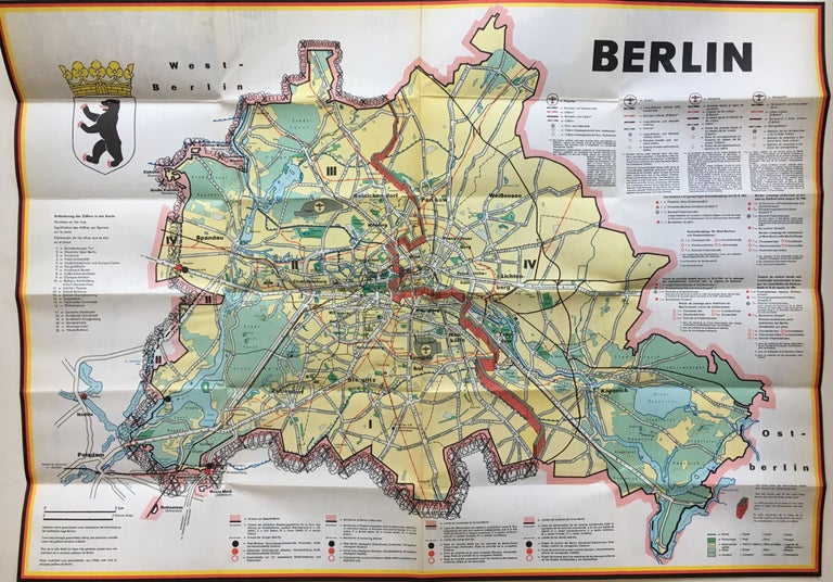
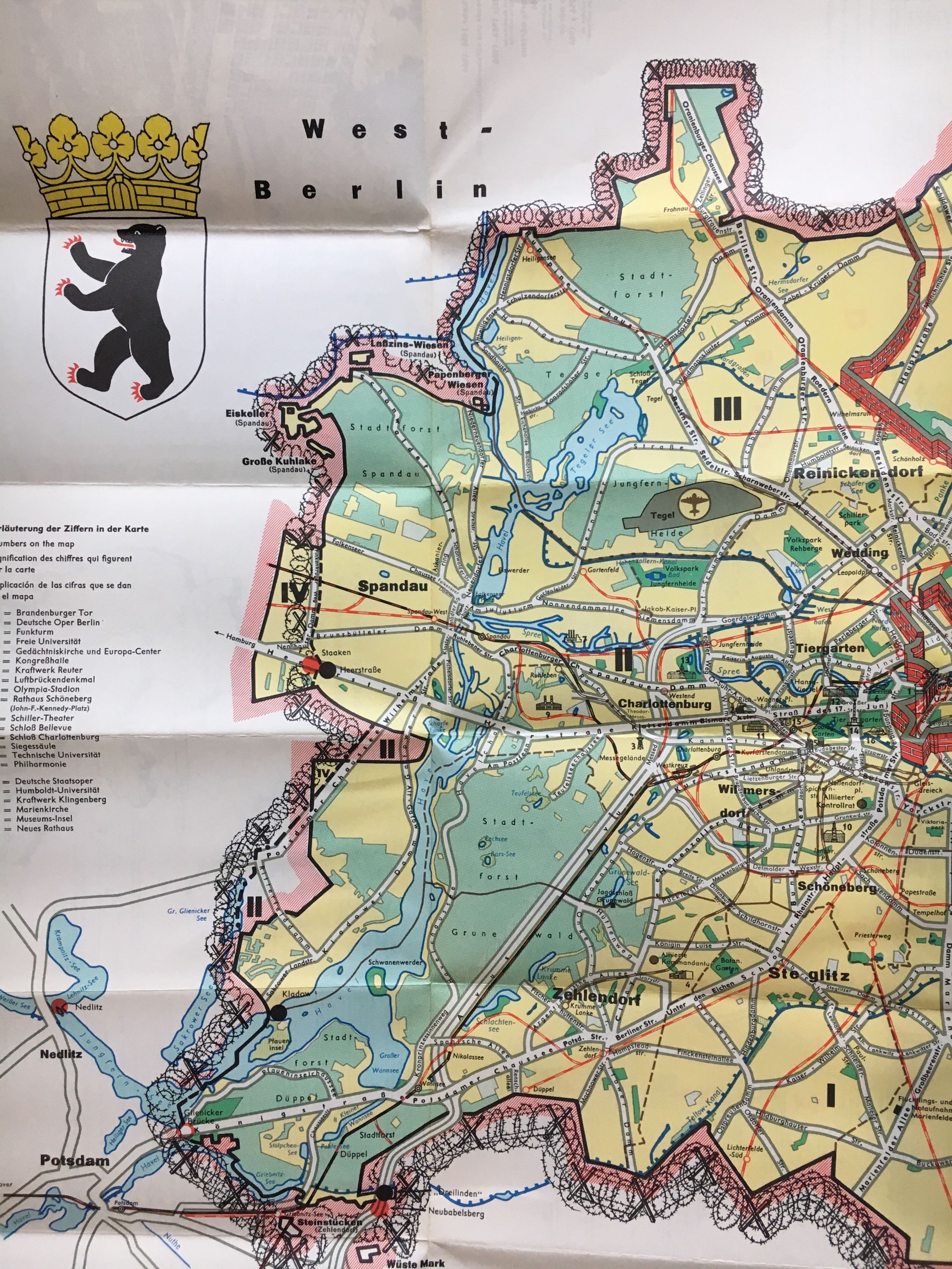
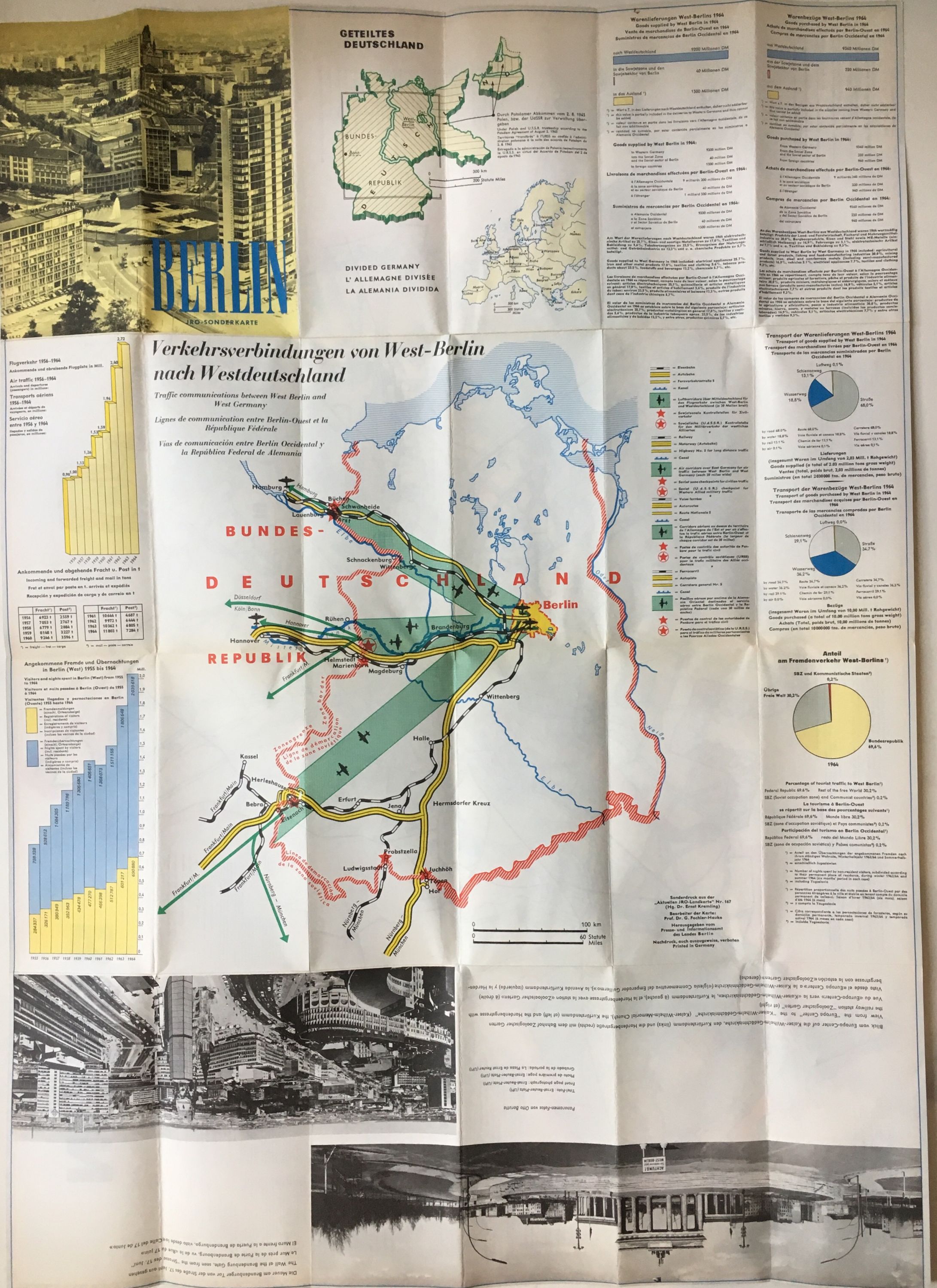
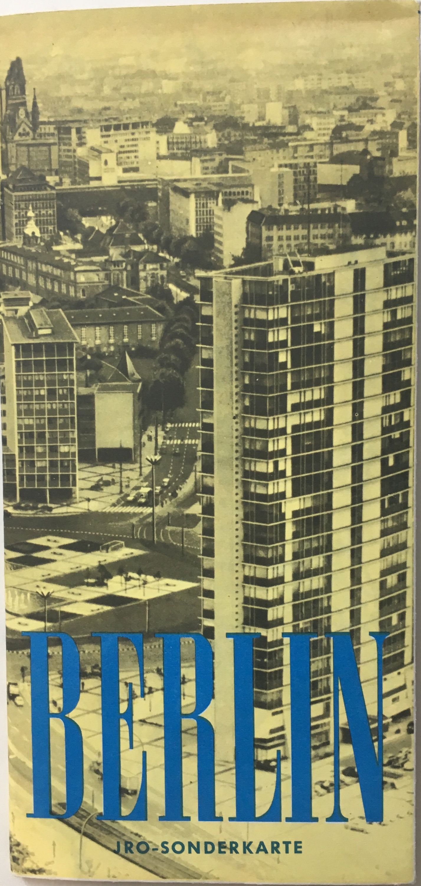
This rare map of Berlin following WWII during the time when it was split into East and West Berlin by the Berlin Wall. It depicts as far west as Potsdam and as far east as Koepenick. The Berlin Wall, depicted as a bricked-up barrier is the focus, emphasizing the division between the two halves. A numbered key on the left notes important sites, including the Brandenburg Gate, the Olympic Stadium, museums, and universities. Another key explains the different colored borders, lines, and dots in German, English, French, and Spanish (such as subway lines/stations, railroad lines/stations, and checkpoints). A third key denotes the different colored regions on the map to show forests, cemeteries, nature reserves, parks, and canals, also in the four languages. There is no Russian on the map, and factories, government buildings, airports, and other sites are only depicted in West Berlin, none are shown in East Berlin. In the top left corner is a depiction of the coat of arms of West Berlin, a black bear on a white shield underneath a golden crown. The map is included inside a pamphlet and takes up an entire side unfolded. The other side includes Cold War logistical statistics for West Berlin. There is an additional photograph of the Brandenburg Gate as seen from West Berlin and a photograph of a view from the Europa Center to the Kaiser-Wilhelm-Memorial Church, the Kurfurstendamm, and the Hardenbergstrasse with the Zoologischer Garten railway station. A map of Germany split into East and West Germany with a focus on traffic communication lines between West Berlin and West Germany. Beautifully designed map.
Illustrator: KREMLING, Ernst
Language: English
Price: $550.00
Item #284093