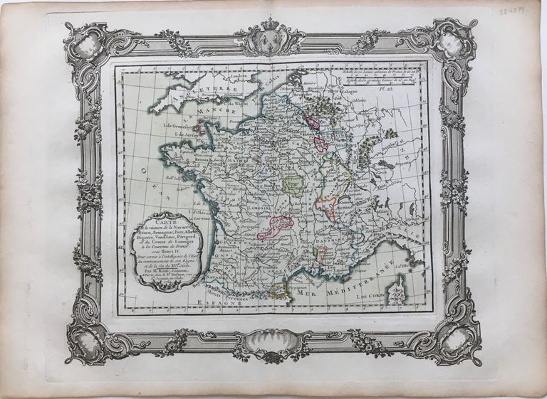
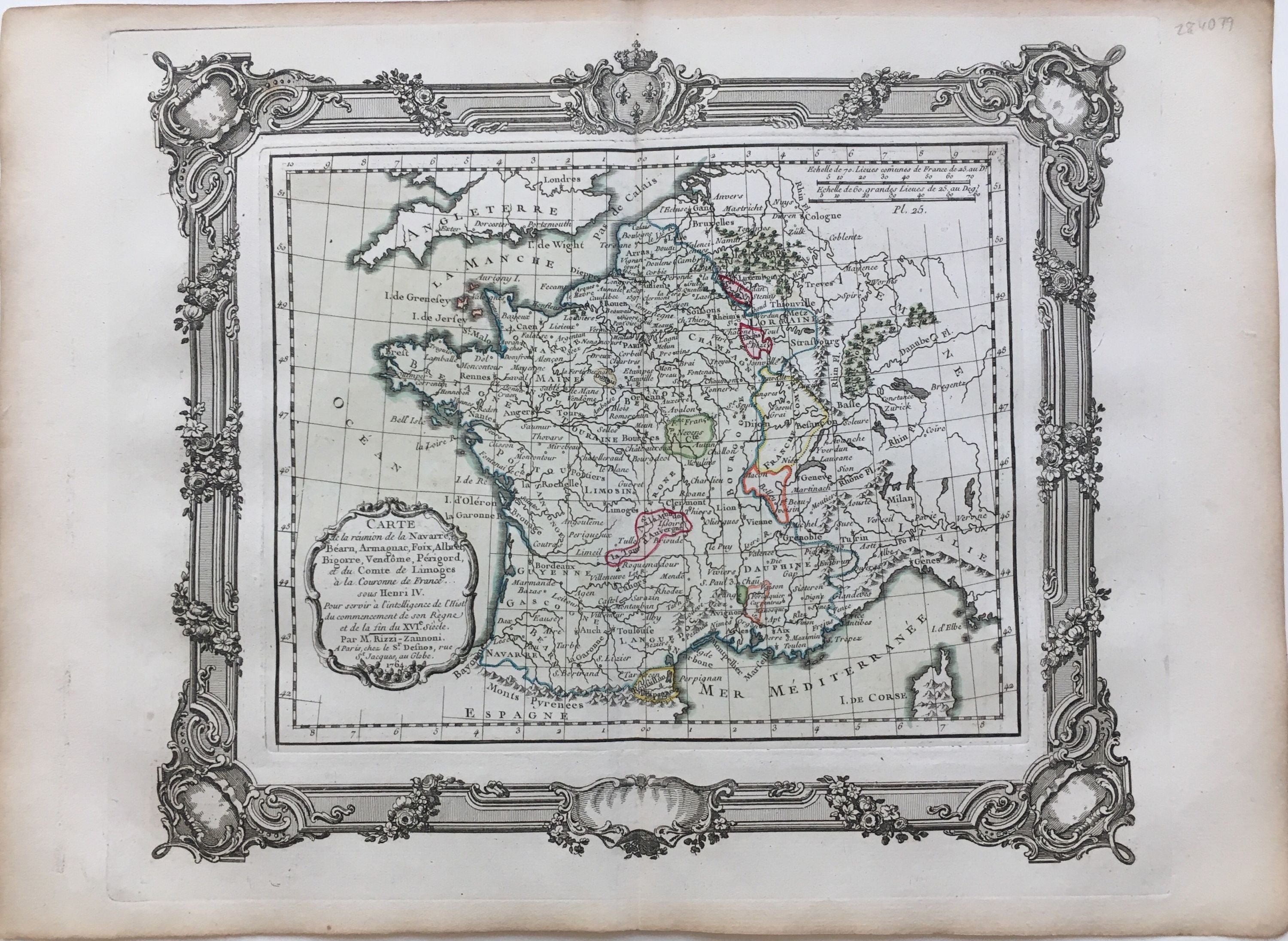
Carte de la reunion de la Navarre, Bearn, Armagnac, Foix, Albret, Bigorre, Vendome, Perigord, et du Comte de Limoges a la Couronne de France sous Henri IV
Bourdeaux: 1764.
Map. Hand colored engraving, uncolored cartouche. Image measures 10 x 11 1/2".
This map of France offers ample detail about the French kingdom during the reign of Henri IV. It is meant to represent the reunification of the provinces listed in the title. It extends from the Atlantic Ocean and the southern border of England to the western border of Germany, and the Mediterranean sea. Published in 1764, the map is labeled with rivers, cities, and lakes, and forests are depicted pictorially. An appropriately uncolored title cartouche in the lower left is decorated with flowers. It is in excellent condition with no chips or tears. Giovanni Antonio Bartolomeo Rizzi Zannoni (1736--1814), an Italian cartographer active in Venice and Naples, was one of the leading cartographers of the 18th century. He is admired for his careful and precise work, which responded to the growing demand in this period for accuracy and detail.
Binding: Unbound
Condition: Very Good
Language: French
Price: $100.00
Item #284079