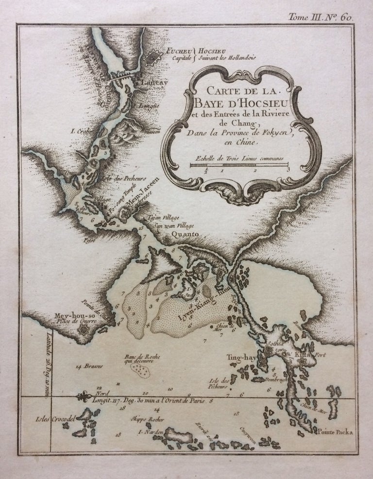
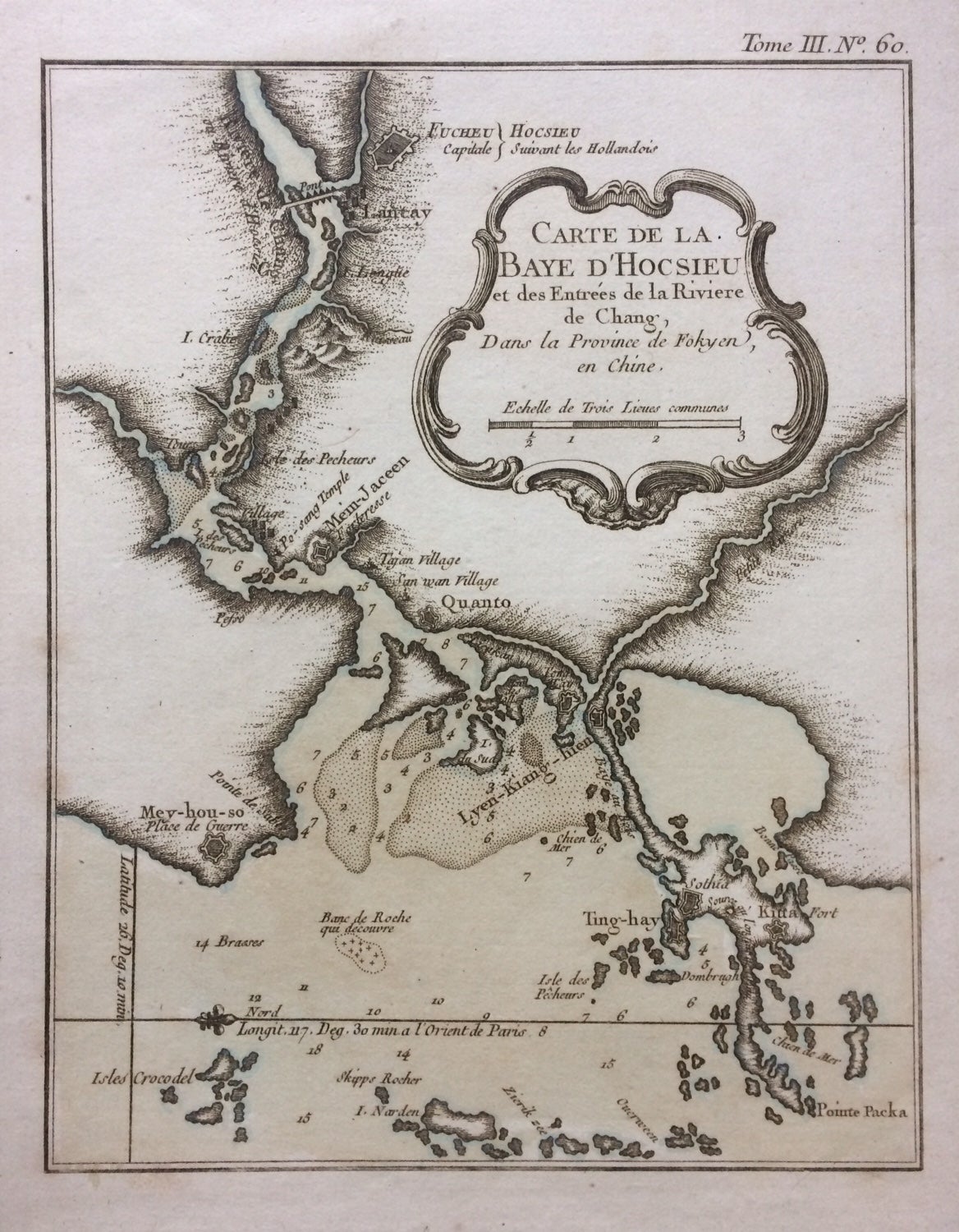
Carte de la Baye d'Hocsieu et des Entrees de la Riviere de Chang, Dans la Province de Fokyen en Chine
Paris: Bellin, Nicolas, 1763.
Map. Copper plate engraving. Image measures 8 1/4" x 6 1/2".
This impressive map or sea chart details the mouth of the Chiang River in the Fujian Province of modern day China. The map covers part of the modern day city of Fuzhou on the southeastern coast of China just west of Taiwan or Formosa. Incredibly detailed, the map notes towns, fortifications, islands, bridges, rivers and mountains with beautifully rendered topography. Several coastal features are noted, included depth soundings throughout, making this a useful map for the mariner. Part of Bellin's "Le Petit atlas maritime". Map retains its natural black and white dark impression. It is in very good condition with minor foxing. Original plate mark visible.Jacques Nicolas Bellin (1703-1772), was the official hydrographer to the French king and the first person to hold the title of "Ingénieur de la Marine of the Depot des cartes et plans de la Marine" (chief engineer of the French Hydrographical Office).
Binding: Unbound
Language: English
Price: $300.00
Item #283710