
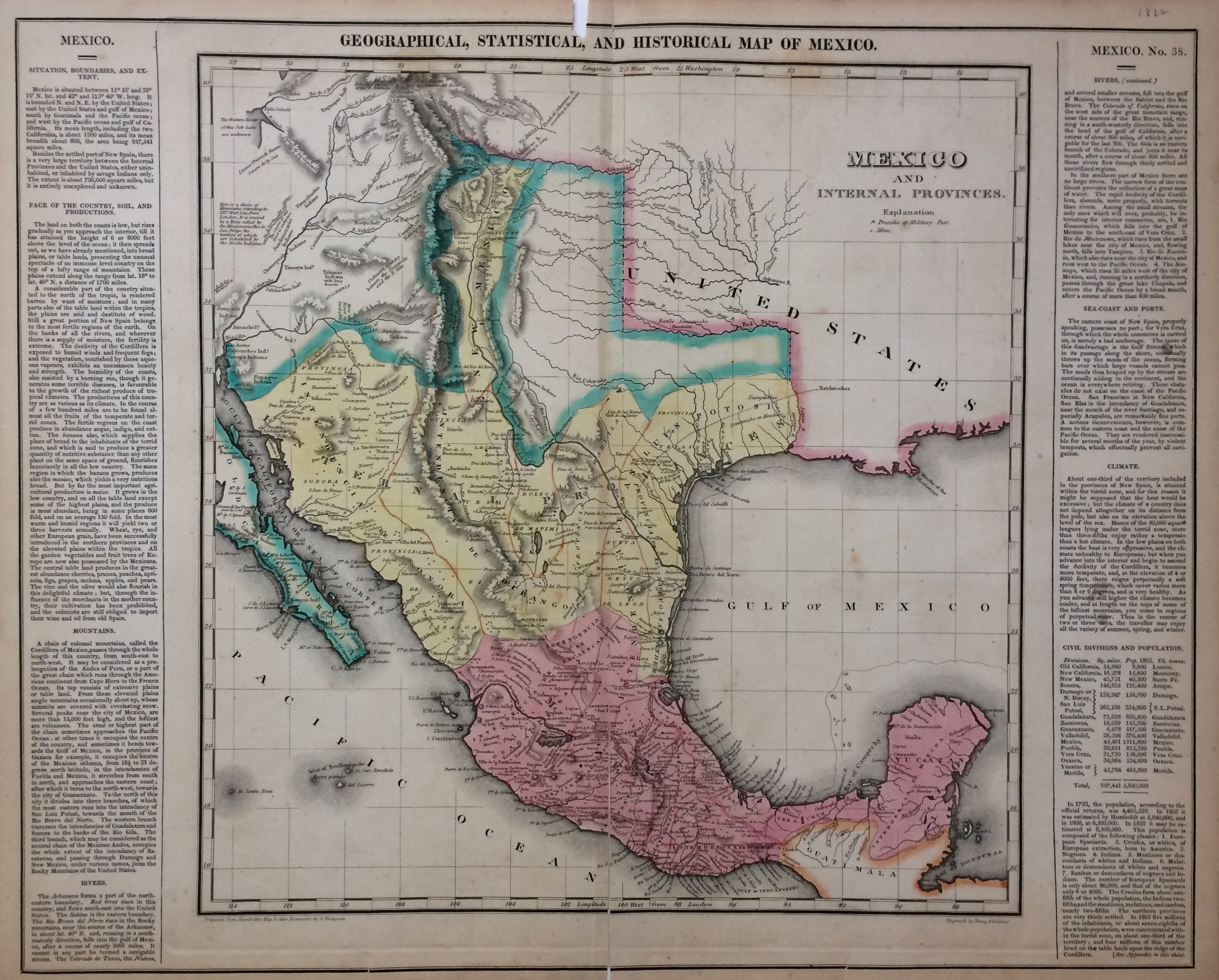
Geographical, Statistical, and Historical Map of Mexico.
Philadelphia: Carey & Lea, 1822.
Map. Engraving with original hand coloring. Image measures 15"x 14.5", image plus text measures 16.5" x 20.5".
This map of Mexico combines a detailed topographical and political rendering with information pertaining to history, climate and culture. It was published in 1822, shortly before Austin's arrival in Texas and immediately prior to Mexico's independence from Spain. The index of the map includes cities, rivers, military posts, and mines, and information about exploration and Indian population is also noted. The map was printed in Carey & Lea's "Complete Historical, Chronological, and Geographical American Atlas." Minor chipping at corners, foxing near title, some discoloration and repairs at centerfold. The Philadelphia-based firm of Carey & Lea of Philadelphia was one of the most important publishers in the early 19th-century United States. Run by Mathew Carey (1760-1839) and Isaac Lea (1792-1886), the company worked with both books and maps, specializing particularly in political commentary. Their "Complete Historical, Chronological, and Geographical American Atlas," first published in 1822, not only contained some of the earliest maps of western states being admitted to the Union, it also provided ample information on those states. As a result, provides an invaluable window into the country's history. This map of Mexico is one of the earliest detailed maps of the region printed in the United States.
Illustrator: J. Finlayson
Binding: Unbound
Language: English
Price: $750.00
Item #279934