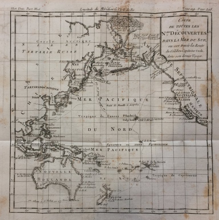
Carte de Toutes les Nles Decouvertes dans la Mer du Sud, ou est tracee la Route du Celebre Capitaine Cook, dans son dernier Voyage.; (Map of all Nations
Louis Brion de la Tour.
Map. Engraving. Image measures 9 x 9 inches. Page measures 11.5 x 10 inches.
Small chart showing the third and final voyage of Captain James Cook through the Pacific. It covers the North American coastline from Mexico through Alaska, the Asian coastline through Cambodia and down to New Zealand. Unusual depiction of icebergs. Foxing throughout. Louis Brion de la Tour (1756-1823) is best known for his 'Atlas General' published in collaboration with Louis Charles Desnos. He held the title of Royal Cartographer to the King of France.
Binding: Unbound
Language: French
Price: $400.00
Item #279926
See all items by Louis BRION DE LA TOUR