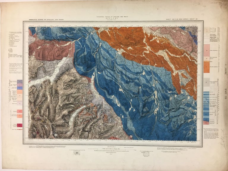
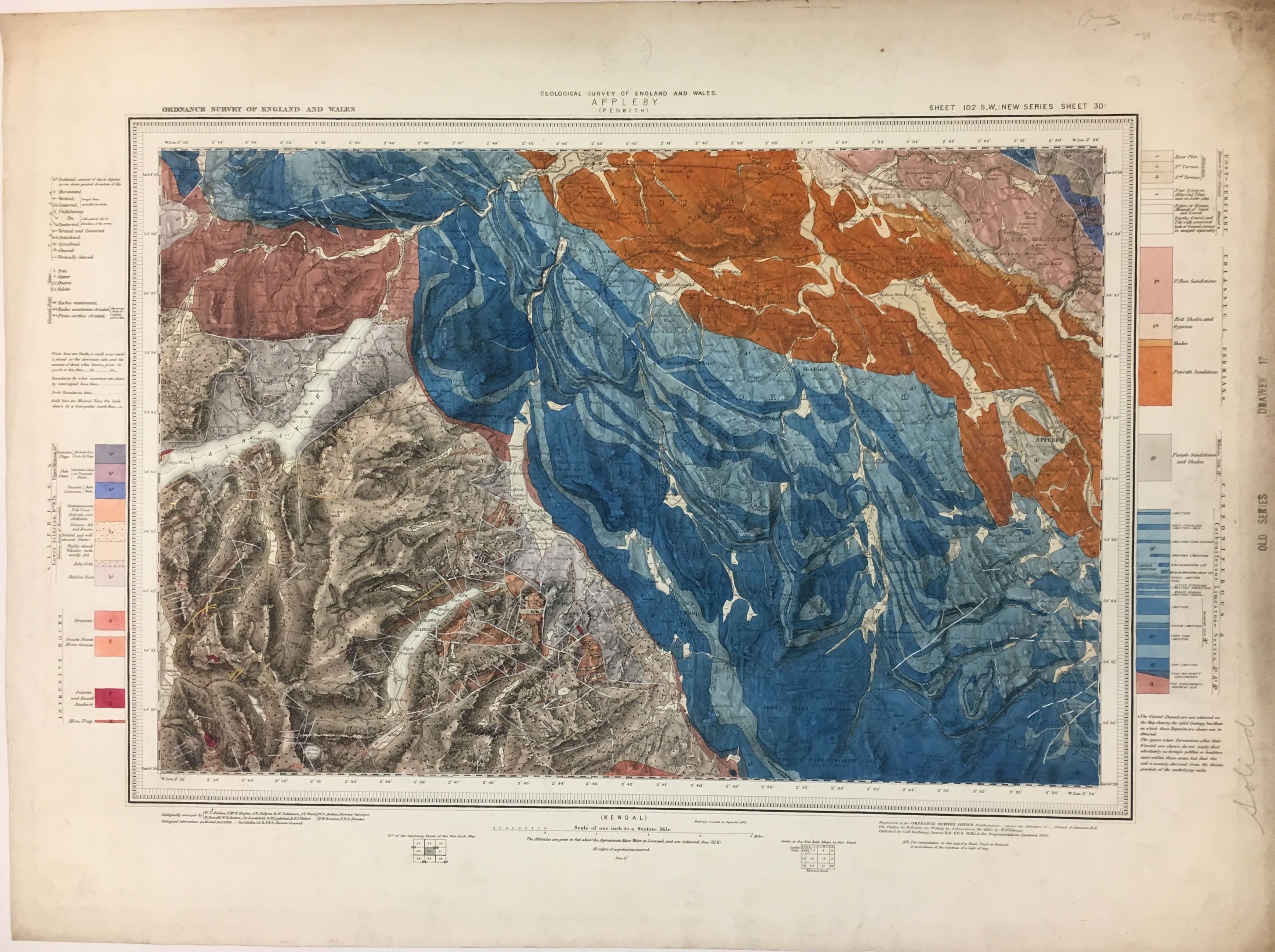
Appleby; Sheet 102 S.W.
Geological Survey of England and Wales, 1893.
Map. Engraving with hand coloring. 15" x 22 1/2". Stamp on left edge stating "Old Series" and "Drawer 17". Original stamp of the Geological Survey of England and Wales present at the top of the page.
Gorgeous hand-colored geological map of the Lake District in Cumbria, United Kingdom showing as far west as Ullswater Lake, as far east as Appleby, north to Penrith, and south to Kendal. A color-coded key to the left and right of the map show the different types of rocks present in the region. Surface scuffs and wear, otherwise good. Ordnance Survey (OS) is a national mapping agency in the United Kingdom which covers the island of Great Britain. It is one of the world's largest producers of maps and was founded in 1791.
Language: English
Price: $165.00
Item #279023