
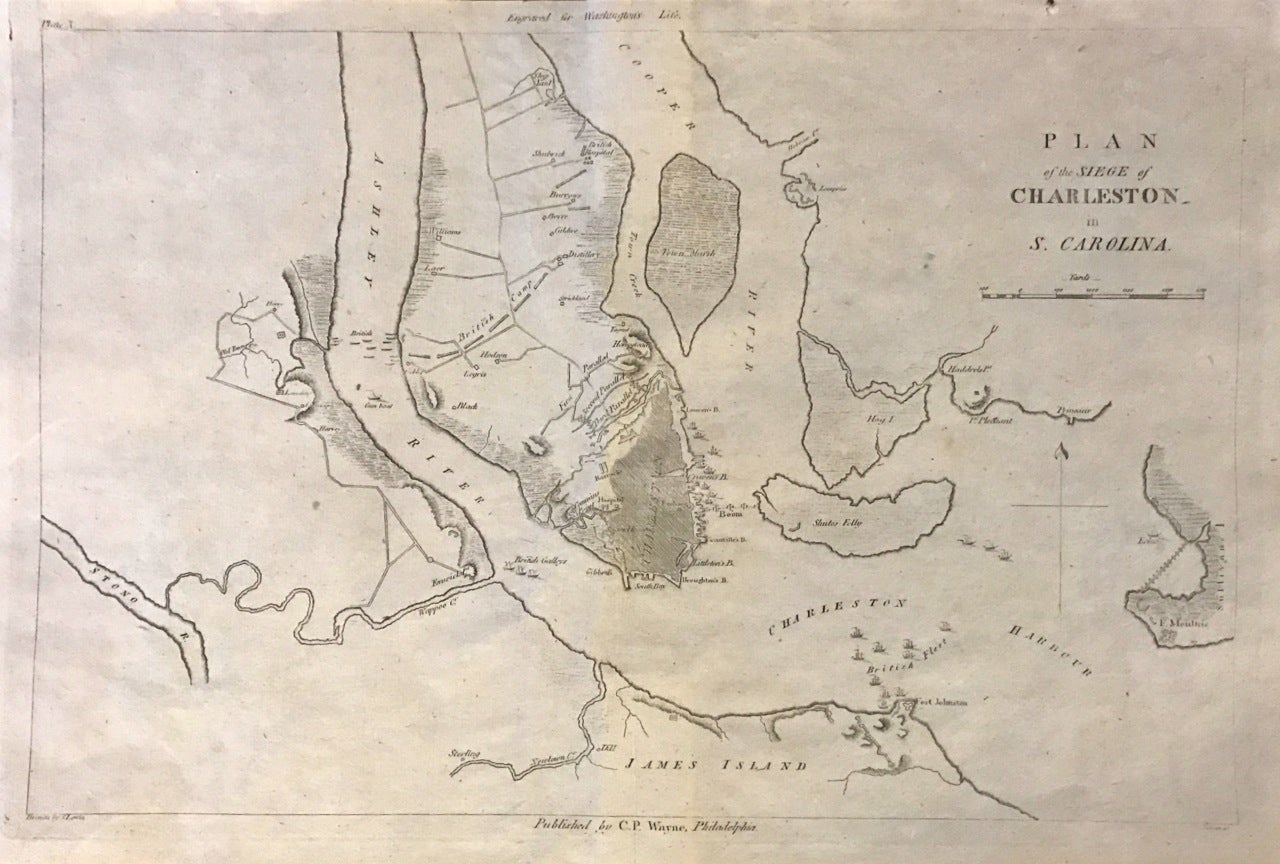
Plan of the Siege of Charleston in S. Carolina
Philadelphia: C. P. Wayne, 1807.
Map. Uncolored engraving. Sheet measures 10.5 x 16.25".
This important 1807 Revolutionary War - era map depicts the Siege of Charleston, one of the major engagements fought during the War. It covers from the Shipyard south to include Charleston Harbor and vicinity, as well as parts of James Island and Sullivan's Island.
After suffering losses in the north, the British shifted their attention to the Southern Colonies and seized Savannah and Charleston by 1779. The Siege of Charleston lasted approximately six weeks from March 29 - May 12, 1780. The continental army under the command of Major Benjamin Lincoln surrounded to the British, resulting in one of the worst American defeats in the War.
To contextualize the armies' paths, the map shows several topographical elements, marshes, islands, ship yards, camps, etc. The map was part of the rare 1807 atlas volume belonging to Chief Justice John Marshall's seminal six volume biography of Washington. In good condition with minor wear along original folds.
John James Marshall (1755--1835) was the fourth Chief Justice of the United States. A renowned Federalist, Marshall's admiration for George Washington led him to publish "The Life of Washington," a five-volume biography of the famed President and general. In 1832, he produced a revised and condensed two-volume edition with hand-colored maps. This map attests both to Marshall's influential work and to the skill of the general it honors.
Binding: Unbound
Language: English
Price: $1,200.00
Item #274605