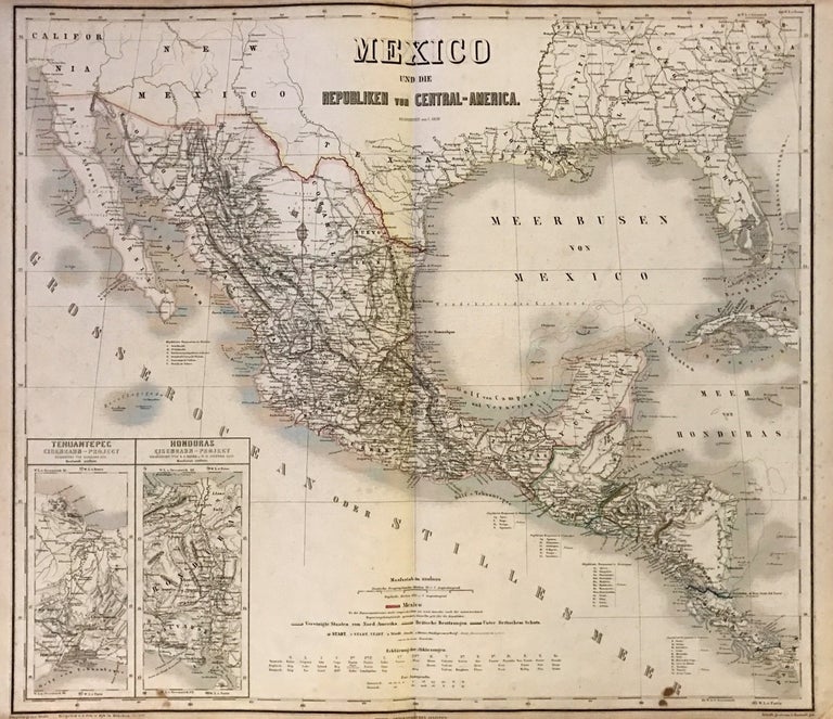
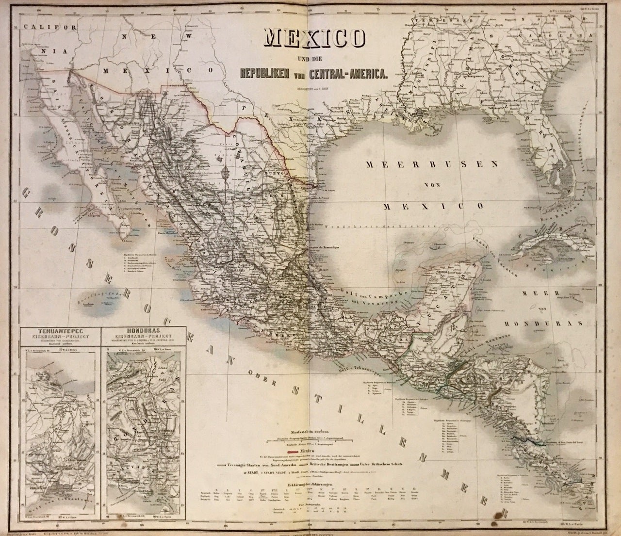
Mexico und die Republiken von Central-America
Weimar: Geographisches Institut, 1866.
Map. Steel engraving with original hand color. Sheet measures 22.5" x 27".
This is a beautiful map of Mexico and Central America dating to 1866. The map is equipped with many small place names, rivers, lakes, roads, railways, etc. The Gulf of Mexico and the Pacific coast are included as are parts of southwest and Southeast United States, including Florida. In the lower left corner we find two inset maps. One shows the railway project of Tehuantepec and the other an inset map of San Salvador and Honduras. The map is in good condition with minor wear and verso repairs along the original centerfold. Minor edge wear, including small crease near bottom right. Stain near lower margin. This map by Carl Graf was issued by the Weimar Geographisches Institut.
The Geographisches Institut of Weimar was a publishing house and research institute that issued globes and works of earlier publishers such as Kitchin, Carey, Jefferys, etc.
Binding: Unbound
Language: German
Price: $300.00
Item #274393