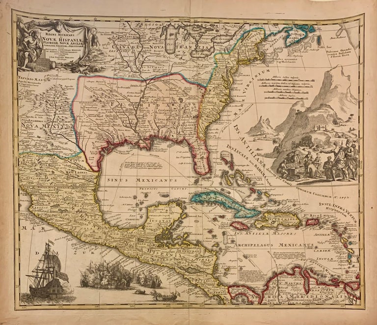
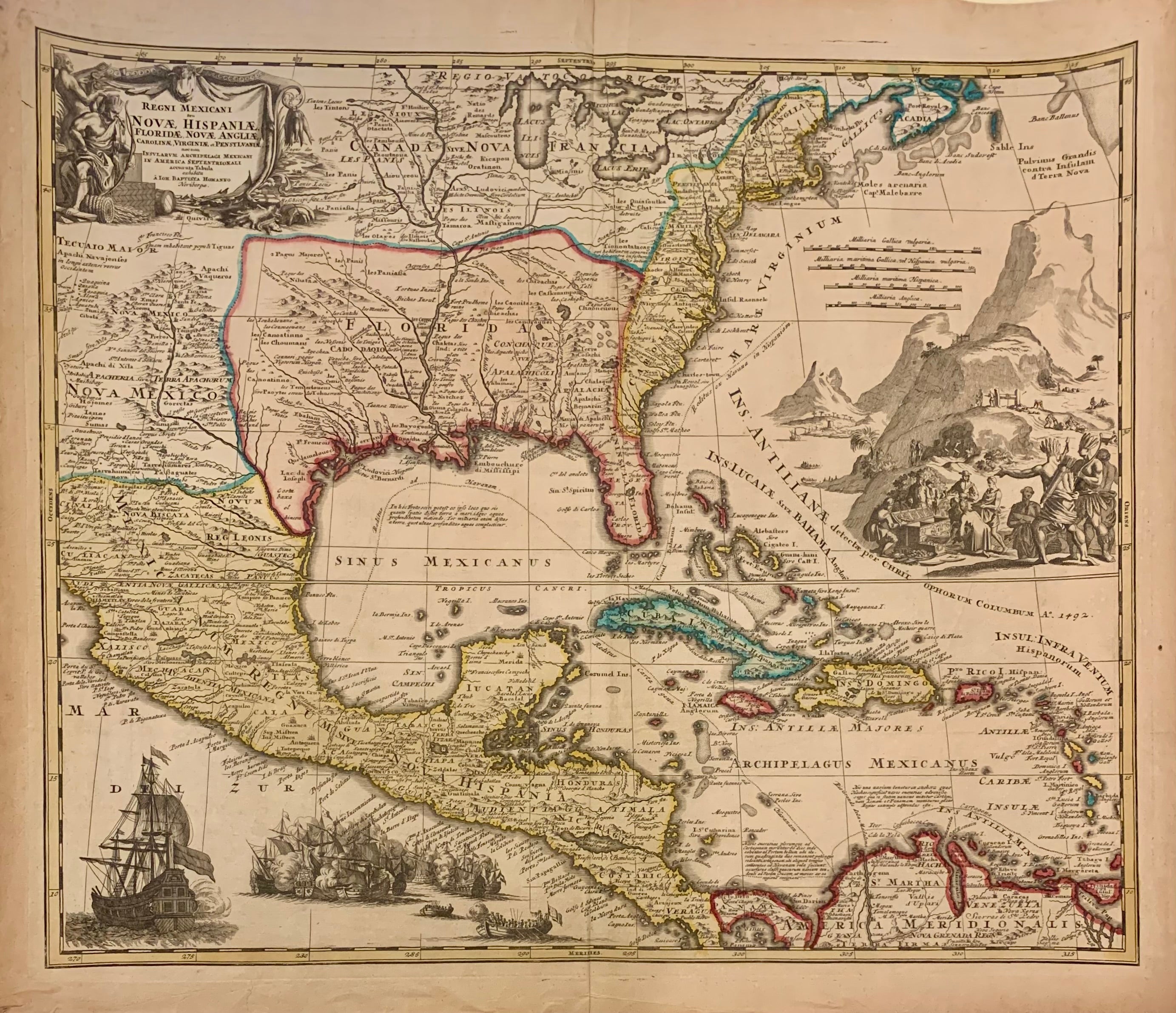
Regni Mexicani seu Novae Hispaniae, Ludovicianae, N. Angliae, Carolinae, Virginiae et Pensylvaniae, necnon Insularum, Archipelagi Mexicani in America Septentrionali
Nuremburg: Homann, Johann Baptist.
Map. Copper engraving with original hand coloring. Image measures 18.75" x 22.5".
This striking circa 1720 map by Johann Baptist Homann extends from the Great Lakes southward to include Florida, West Indies, Central America, up to Venezuela, and from New Mexico to the eastern seaboard. Based on the 1703 Delisle map of Mexico and Florida, this map includes information from the explorations of La Salle, Bienville, Le Sueur, d'Iberville, Lederer, and other early travelers.
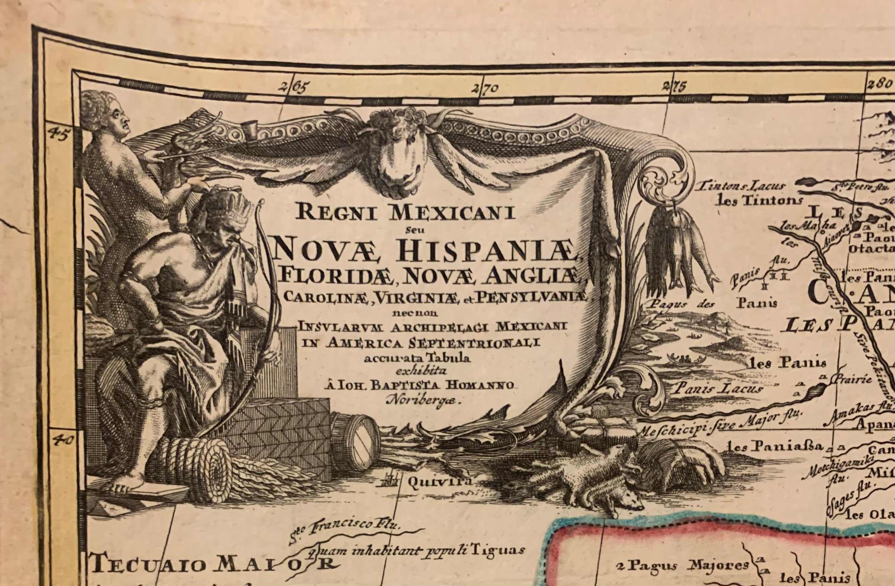
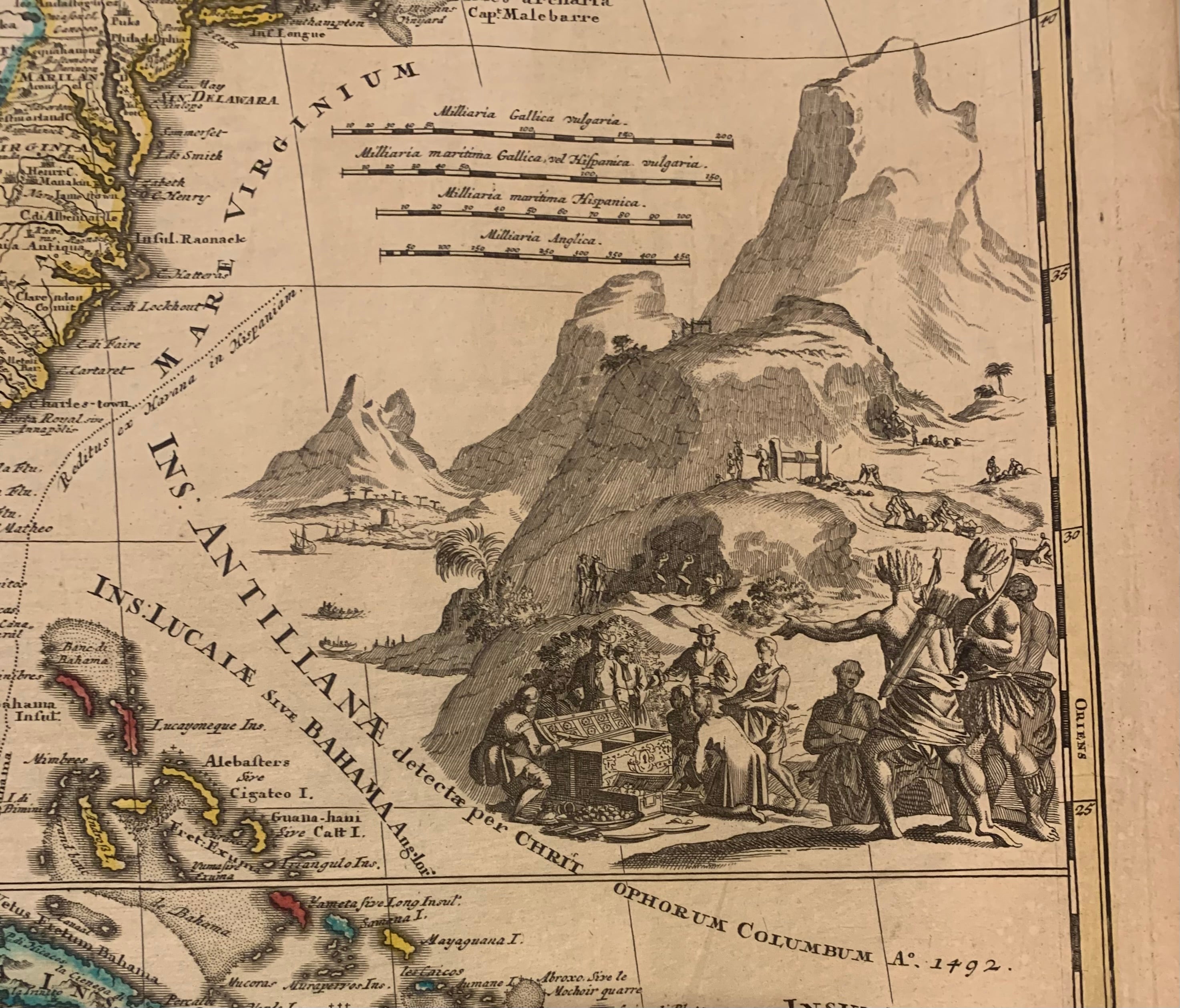
The most striking features of this map are the elaborate cartouches. The title cartouche in the top left depicts Native American figures along with the various natural resources of the Americas including beaver pelts and tobacco rolls. A large cartouche in the Atlantic depicts a gold mining scene with natives helping Europeans fill their chests with treasures. The third cartouche just off the Pacific Coast of Mexico depicts a sea battle with a large warship (likely British or French) and a smaller fleet (likely Spanish). These cartouches enhance the focus of this map.
The British colonies are accurately shown along the east coast, east of the Appalachians. Following the 1713 Treaty of Utrecht, French claims in Louisiana extend from the Rio del Norte to the Appalachians and include Florida and north to include the Great Lakes and St. Lawrence in 'Canada Nova Francia'. Spanish influence can be noted in the west and south to include Mexicana, Nova Hispania and America Meridionalis. Dotted lines track the routes of the Spanish fleets.
Throughout, the map notes several place names, native tribes, villages, early settlements, forts, and several other topographic features. The kingdom of Quivira, the supposed ancient city of gold in North America, is identified just below the title cartouche. In good condition with minor wear along the original centerfold and minor foxing at places. Appropriate original coloring with the cartouches left black and white.
Johann Baptist Homann (1664-1724) was a renowned German mapmaker of the late 17th and early 18th century, including being geographer to the Holy Roman Emperor. His business was carried on through the 18th century by the Homann Heirs, also prolific and popular mapmakers.
Binding: Unbound
Language: English
Price: $2,750.00
Item #273626