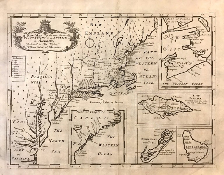
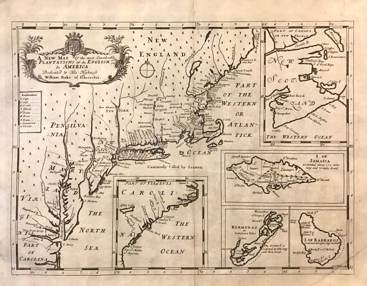
A New Map of the Most Considerable Plantations of the English in America
Oxford: Edward Wells, 1701.
Map. Uncolored copper plate engraving. Image measures 14" x 19".
This fine antique map by Edward Wells presents the English plantations in North America as they were in 1701. Covers the regions from modern day Maine to North Carolina. Major towns and colonies are identified along the coast and major Rivers, while little inland detail is noted. New Albanie on the Hudson is noted, as are Baltimore on the Delaware peninsula and Green Spring near Jamestown (the plantation home of the Governor of Virginia, Sir William Berkeley).
The map includes five inset maps depicting other British colonies. These include the Islands of Jamaica, Bermuda and Barbados. The inset of Carolina refers to the cartography of John Lederer, with the appearance of the spurious Ashley Lake and the May River. The last inset features the disputed region of New Scotland and features Port Royal, which was taken briefly by Sir William Phipps in 1609.
This the second state of the map with the plate number 41 appearing below the beautifully engraved title cartouche. The map is in very good condition with minor wear along centerfold. Published in "A New Sett of Maps Both of Antient and Present Geography". Engraved by Nicolls Sutton.
Edward Wells (1667-1727), a mathematician and geographer, dedicated this atlas to the young Duke of Gloucester, son of the future Queen Anne. The Duke (age 11) was studying at Oxford at the time of printing and his tutelage may account for Wells' unusually sparse style. Instead of focusing on grand decoration, perhaps Wells used a simpler approach for educational purposes. Beautifully engraved.
Binding: Unbound
Language: English
Price: $2,400.00
Item #273482