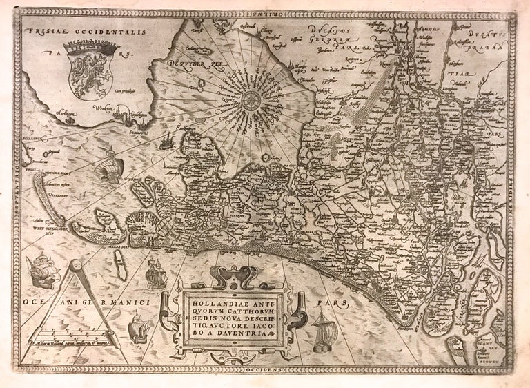
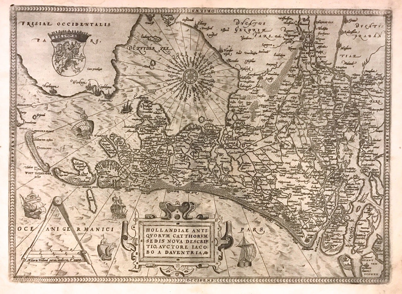
Hollandiae Antiquorum Catthorum Sedis Nova Descriptio
Antwerp: Abraham Ortelius, 1592.
Map. Uncolored engraving. Sheet measures 16" x 21".
This beautiful 1588 map by Abraham Ortelius depicts Holland or the Netherlands in exceptional detail. The map covers the regions near the Wadden Sea roughly covering modern day provinces of North Holland, South Holland and Utrecht. The map, centered on Amsterdam, is oriented with north to the left. Topographical and geographical features such as mountains and cities are beautifully rendered in profile.
The waters surrounding the region are shown with waves and include several illustrations of ships throughout. This is the first state of the map, with later states showing a stippled sea rather than waves. Includes a large strapwork title cartouche, scale of miles with a divider in the lower left. The Royal coat of arms is presented in the top left. The map also includes a 16-point compass rose.
Ortelius based this map on the work of Jacob van Daventer. Published in the 1588 edition of Ortelius' famous "Theatrum Orbis Terrarum," which is historically considered the first modern atlas. Based on the text on verso, only 300 copies of this particular edition were ever printed (van der Broecke 79).
The map is in good condition with minor wear along the original centerfold. Minor foxing at places. Original plate mark is visible. Latin text on verso.
Abraham Ortelius (1527--1598), a Flemish cartographer and geographer, is widely regarded as one of the important and influential cartographers in history. He is known for his "Theatrum Orbis Terrarum," which was the first modern atlas. Hard to find in black and white.
Binding: Unbound
Language: Latin
Price: $975.00
Item #273298