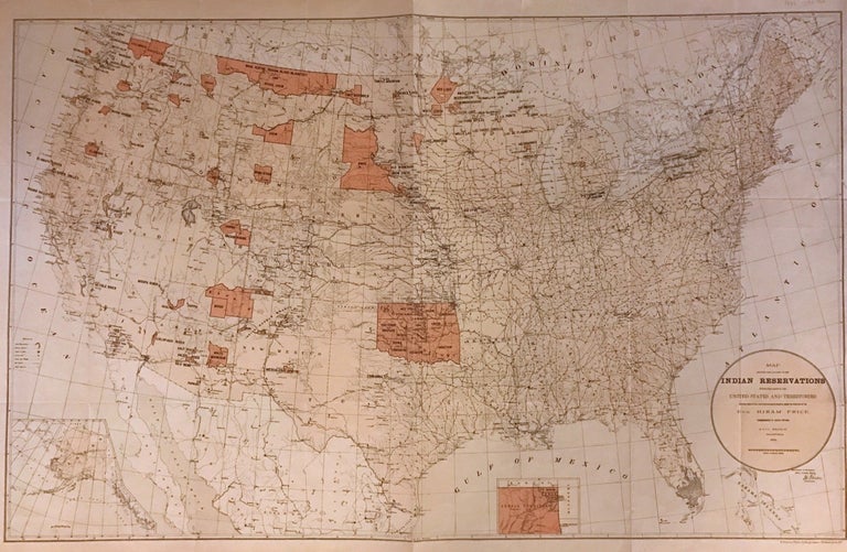
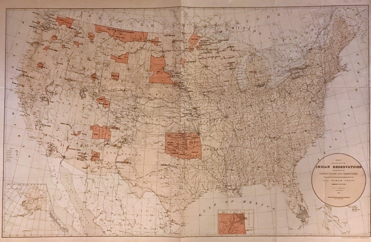
Map showing the location of the Indian Reservations within the limits of the United States and Territories
Washington: Department of the Interior, 1888.
Map. Color lithograph. Sheet measures 23.25" x 34.5".
This large 1884 map presents the Indian Reservation in the United States and its territories. It covers the entire United States, with Alaska as an inset in lower left. Another inset shows the Indian Territory in northwest Oklahoma. The map identifies Indian Reservations and names. Military stations, Indian agencies, towns, villages, cities, railroads, rivers, mountains, and other topographic features are also noted. Compiled under the direction of Hon. Hiram Price, Commissioner of Indian Affairs. The map was issued by the Department of the Interior. In good condition with wear along the original folds. Margins show damage with some verso repairs.
Binding: Unbound
Language: English
Price: $500.00
Item #272708