
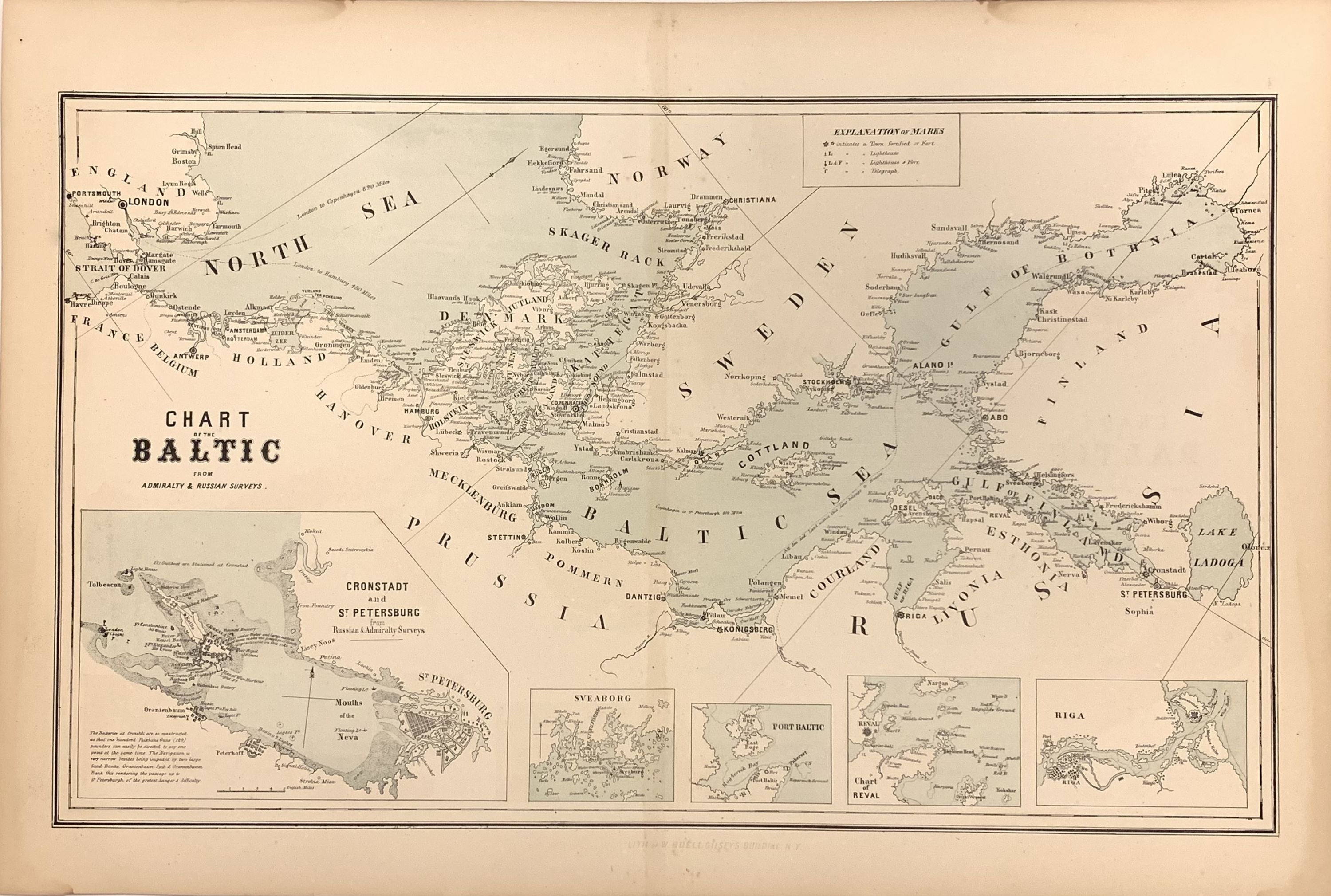
Chart of the Baltic from Admiralty & Russian Surveys.
New York: William Boell, 1857.
Map. Color lithograph. Image measures 11.75" x 14.25".
This scarce chart of the Baltic Sea is exceptional for its precise rendering of the coastlines between Scandinavia and the coast of Western Europe. The waters of the central Baltic Sea extend outward into the Gulfs of Bothnia and Finland in the west and the North Sea in the East. Along the coasts, towns, forts, and lighthouses are labeled and establish a level of detail that carries over into the five insets along the bottom of the map. The largest, showing Coronstadt and St. Petersburg, includes multiple useful tips for navigators that identify dangerous conditions. The other four Sveaborg, Port Baltic, Reval, and Riga highlight some of the bustling ports in this significant region of European waterways. The map is in very good condition with full margins as issued. Light staining around edges not affecting the image. Map is bright and clean except for some slight discoloration along the center fold. It first appeared in Charles Desilver's edition of S.A. Mitchell's "New Universal Atlas" as published in 1856. This edition was published in New York by Boell.
Binding: Unbound
Language: English
Price: $300.00
Item #272208