A Concise View of the Number, Resources, and Industry of the American People.
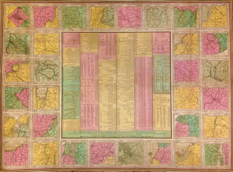
Philadelphia: S. Augustus Mitchell, 1842.
Map. Lithograph with original hand coloring. Sheet measures 25.5" x 34.75.
This 1842 case map by Samuel Augustus Mitchell offers a wealth of information about the United States. The centre of the page includes statistical data from 1840 relating to population, manufacturing, canals, exports, railroads, agriculture, mining, rivers, etc. This information is surrounded by 32 maps of major cities. Some of these include Cincinnati, Detroit, New York, Charleston, Washington, New Orleans, Hartford, and Richmond, among others. Each map is surrounded by an ornate border. This map is the pocket map version of a larger wall map. In good condition with some wear along the original folds. Some foxing and toning at places. Lined with Japanese tissue.
Samuel Augustus Mitchell Sr. (1792-1868) is one of the pioneers in American cartography of the 19th century and led the conversion of engraved map plates to more affordable lithographic plates. Bold design and hard to find.
Binding: Unbound
Language: English
Price: $1,550.00
Item #270733