Southampton
London: Tallis, John, 1851.
Map. Black and white steel engraving. Image measures 13.5" x 9.75".
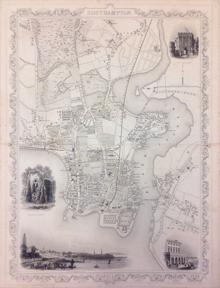
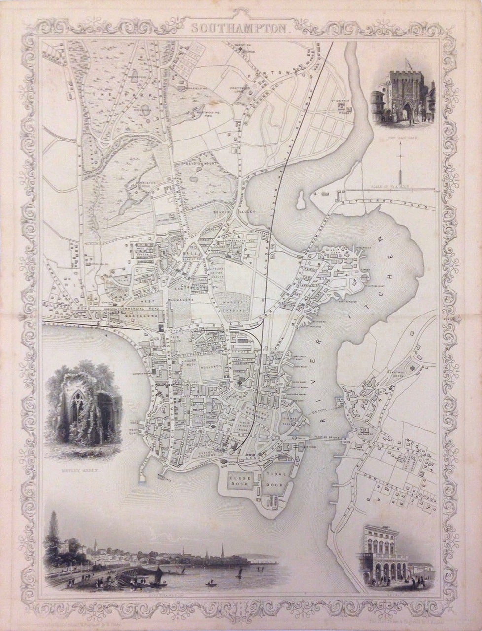
This lovely map detailing the city of Southampton on the southern coast of England is exceptionally detailed and offers both geographical and cultural overviews. The map extends from The Park (now Southampton Common) south to Woolston. Individual streets, buildings, parks, docks, railways, and other topography labeled throughout. The decorative vignettes around the map amplify the cultural milieu perceived at the time. These include a view of Southampton, the railway station, the Bar Gate and Netley Abbey. The whole is surrounded by an ornate border. This map is from Tallis's 1851 "Illustrated Atlas." It is in good condition. Some wear and split along original centerfold. Minor foxing. John Tallis Jr. (1817-1876) was a London born bookseller who continued the prolific map publishing company started by his father. After a partnership with his brother, Tallis Jr. expanded the business to New York in 1849 as well as Boston, Cincinnati, Rochester, Philadelphia and Baltimore. He is remembered as one of the last decorative map makers, and this lovely map exemplifies his work. Hard to find.
Illustrator: Rapkin, J.
Binding: Unbound
Language: English
Price: $350.00
Item #269927