
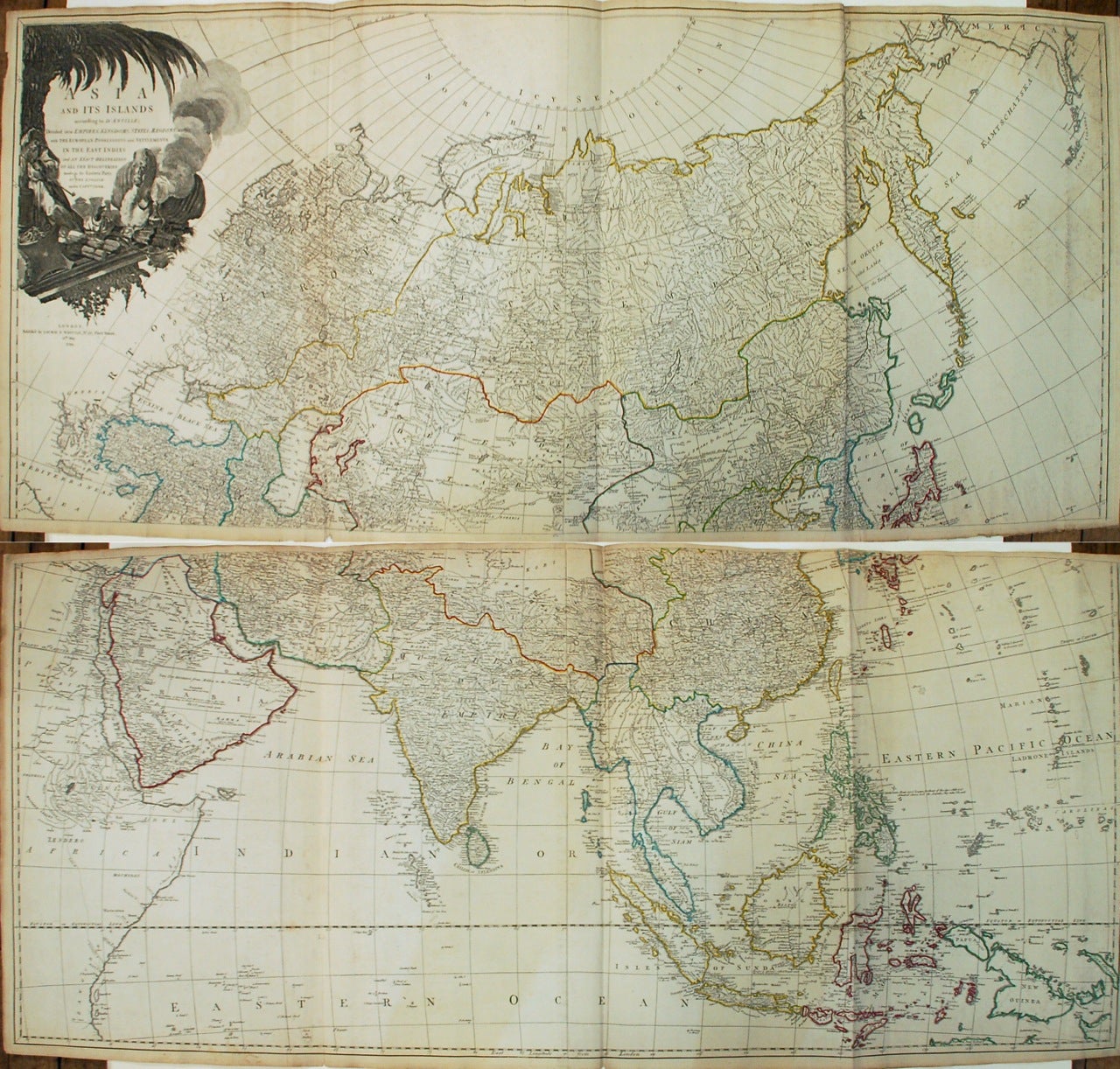
Asia and its Islands According to d'Anville; Divided into Empires, Kingdoms, States, Regions, etc...
London: Laurie & Whittle, 1794.
Map. Engraving with hand coloring. Together measure 42" x 48".
This informative late 18th-century wall map of Asia is based on the cartography of the famous French cartographer Jean Baptiste Bourguignon D'Anville. He was particularly interested in the Far East, making exact studies from many sources, and including the excellent contributions made by Jesuit missionaries to China and Indonesia. It is interesting to note the Asiatic royal leader in the cartouche with an opium pipe, for it was at this time that the export of opium to China from India began. The cartouche also illustrates other items of trade: cotton and silk, spices, and tea and a cute camel. Historical and geographical notes throughout identifies cities, caravan routes, undersea shoals, rivers, lakes, islands and topography.
In East Asia, the discoveries of the Russians and Dutch are noted, including those of Bering (Behring Island, where he died includes a note "where he was cast away and died in 1741"). Central Asia, which was more or less unmapped at the time, shows interesting detail. The supposed "ancient seat of the Monguls Empire" is identified. The Straits of Singapore are labeled. Singapore Island, although not identified, is noted.
It was published by Laurie and Whittle in Thomas Kitchin's "General Atlas". The sheets are in good condition with overall toning and some foxing at places. Minor wear along the folds and some edge wear.
Thomas Kitchin (1719-1784) was an English engraver and map-maker. His maps and atlases of England earned him the position of hydrographer to the King. Kitchin produced many maps for The London Magazine which was founded in 1732 and is still published today.
Robert Laurie (c. 1755 - 1836) and James Whittle (1757-1818) were London-based map and atlas publishers active in the late 18th and early 19th century. Their firm combined Laurie's engraving skills with Whittle's social contacts and print sales experience. Together, they published numerous maps and atlases, often enlisting prominent cartographers such as Kitchin, Faden, Jefferys and others to update and modify their plates.
Jean Baptiste Bourguignon d' Anville (1697-1782) was a French geographer and cartographer whose accurate, research-based work raised the standards for 18th-century map-making. Passionate about maps from his childhood, he created maps during his school years and would go on to publish several atlases during his prolific career. In his early 20's he became the Geographer to the King of France. His accuracy and in depth research would make him one of the most important cartographers of the 18th century.
Binding: Unbound
Language: English
Price: $2,800.00
Item #268446