
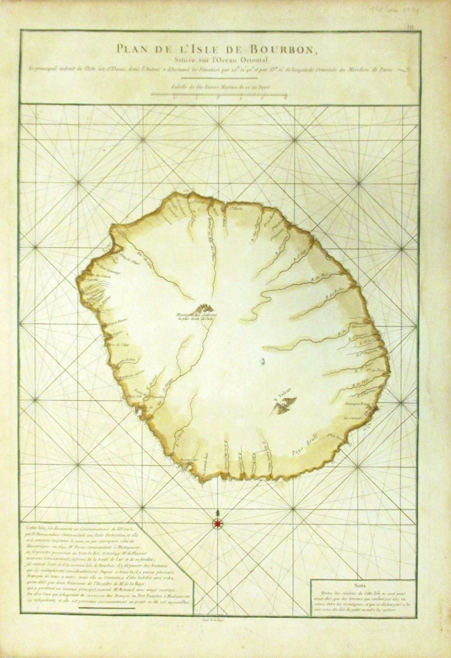
Plan de l'Isle de Bourbon, Situee sur l'Ocean Oriental.
Paris: Le Neptune Oriental.
Sea chart. Copper plate engraving with original hand color. Image measures 19 x 13".
This beautiful map of the Isle of Bourbon or modern day Reunion dates to 1775. It covers the entire island, noting coastal details and some inland topography. The sea chart is covered with rhumb lines throughout and depicts a very remote region of the Indian Ocean. Text in the lower left describes the history, including its discovery and naming of the island. Bourbon was discovered by the Portuguese in the the early 16th century and later claimed by France in 1642 and renamed Ile Bourbon until 1848, when it was given the name "Ile de la Reunion". Today, the island is one of the overseas department of France.
The map, published in circa 1775, appears in Apres de Mannevillette's "Atlas Le Neptune Oriental." It is in good condition with minor toning and foxing and slight damp stain near the top right border. Original plate mark is visible.
Apes de Mannevillette (1707-1780) was a famous French sailor and hydrographer. After a voyage to China, he sought publish all the existing maps of the route to China with corrected latitudes based on new scientific measurements. His maps of the Red Sea, the coasts of India, Malaya, the northern parts of Indonesia, Indochina and China are considered some of the period's best sea charts of the region.
Language: French
Price: $375.00
Item #266584