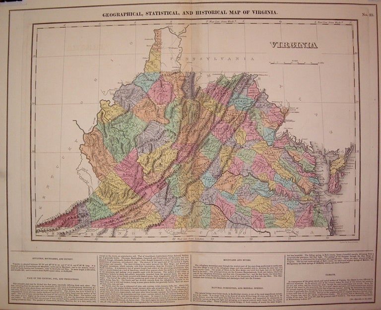
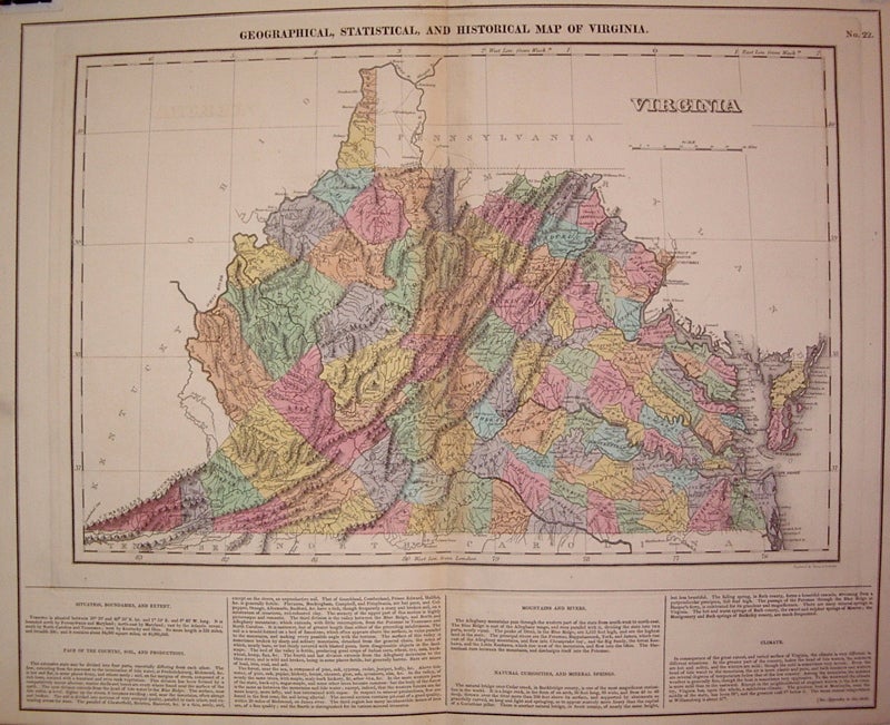
Geographical, Statistical, and Historical Map of Virginia
Philadelphia: Carey & Lea, 1823.
Map. Engraving with original hand coloring. Map measures 12" x 18". Map plus text measures 16.5" x 20.5".
Early map of Virginia divided into counties. Shows towns, waterways, major routes and topographical features. Surrounding text includes geographical information and a separate appendix has information on demographics, chief towns, internal improvements, canals, literary fund, education, agriculture and commerce, government and religion. Appendix included. From "A Complete Historical, Chronological, and Geographical American Atlas..." of 1822. Minor toning along centerfold, professional reinforced.
The Philadelphia-based firm of Carey & Lea of Philadelphia was one of the most important publishers in the early 19th-century United States. Run by Mathew Carey (1760-1839) and Isaac Lea (1792-1886), the company worked with both books and maps, specializing particularly in political commentary.
Binding: Unbound
Language: English
Price: $500.00
Item #265894