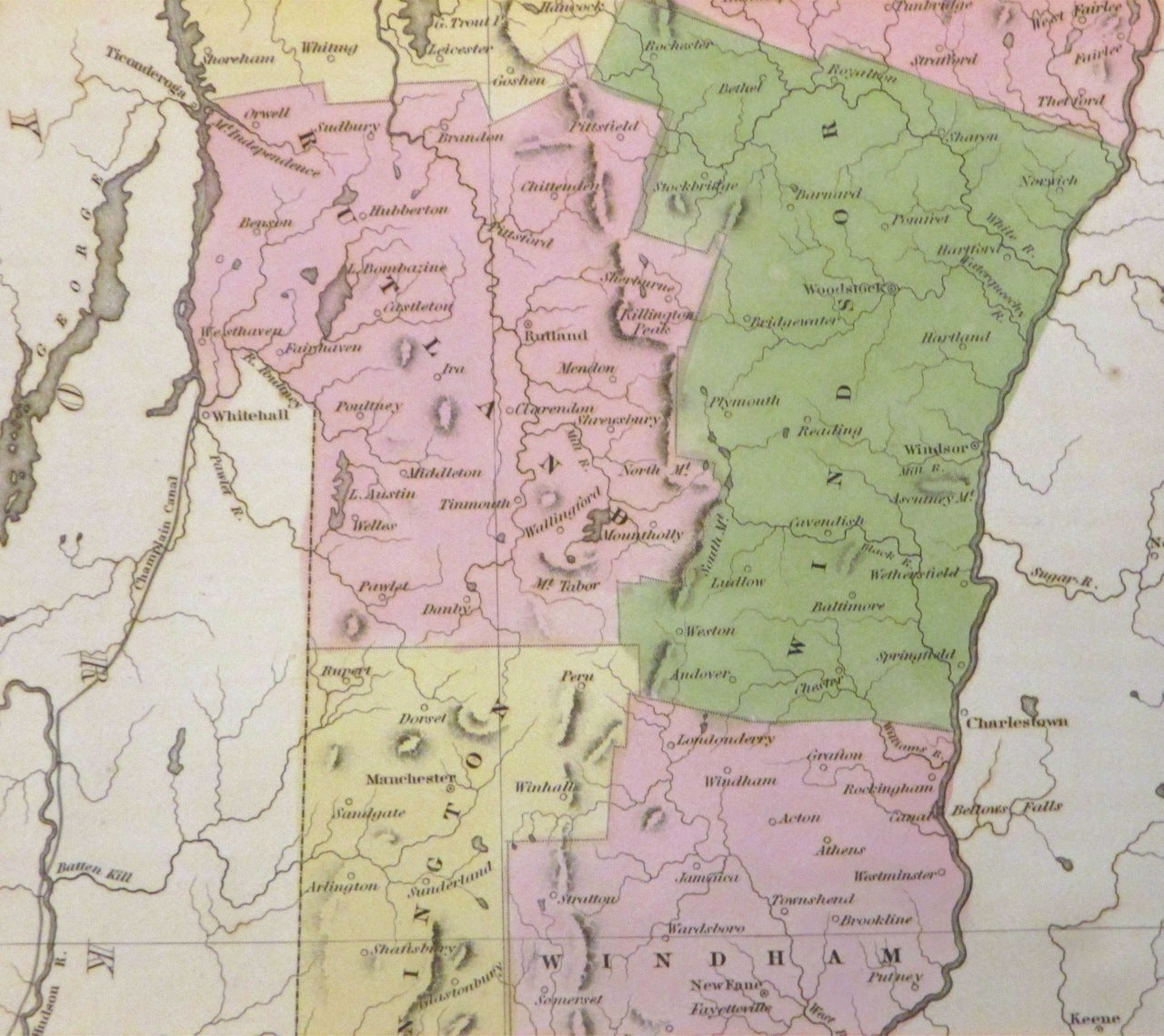
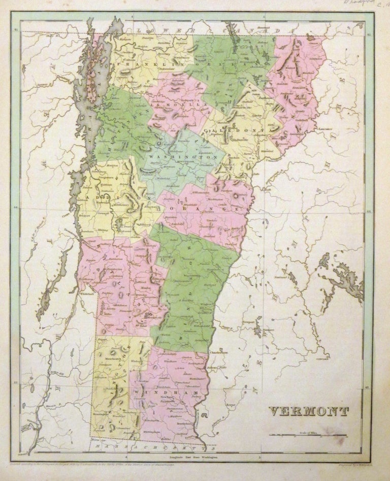
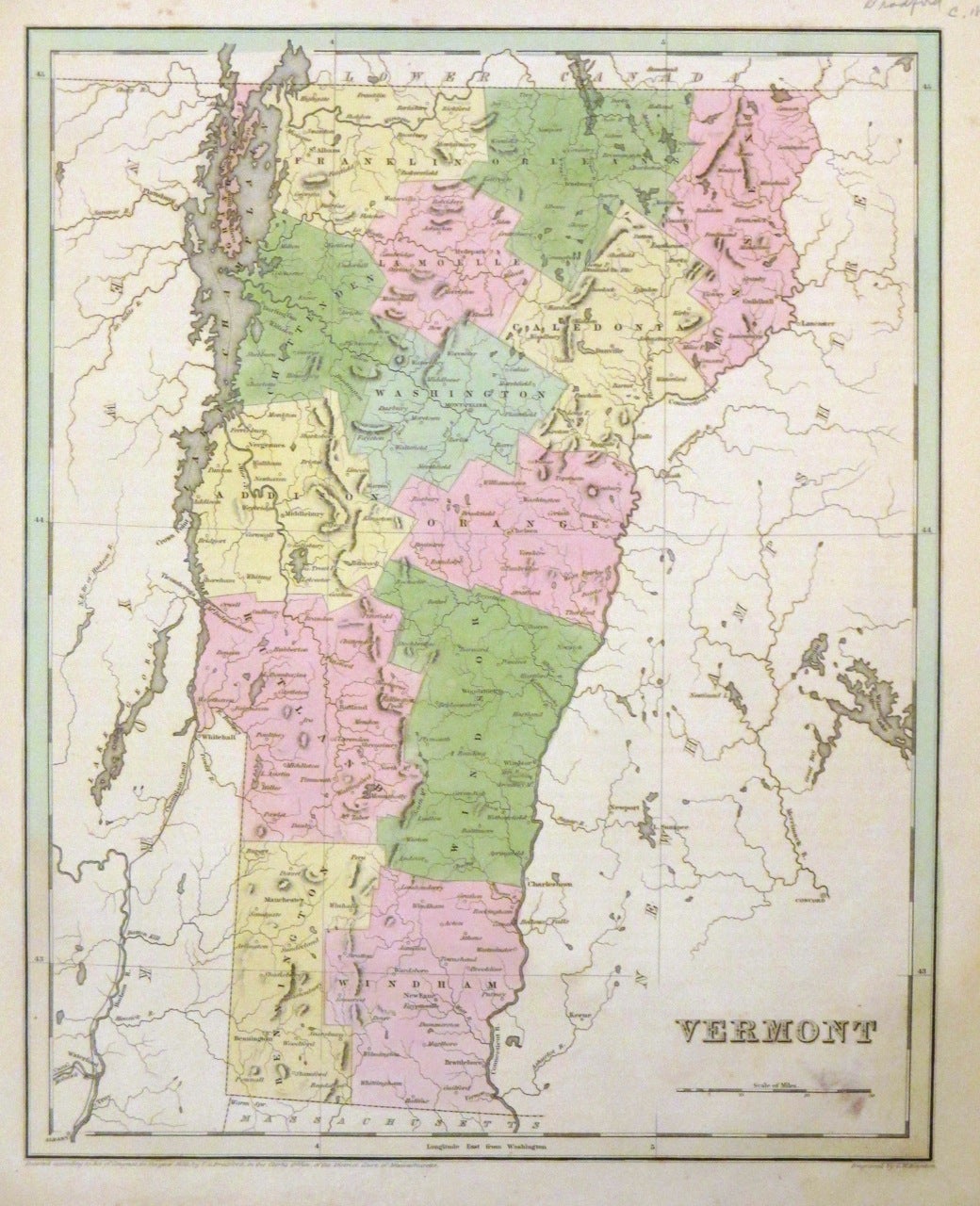
Vermont
Boston: T.G. Bradford, 1838.
Map. Engraving with original hand coloring. Image measures 14.5 x 11".
This map of Vermont is a portrait of the state in 1838 divided into counties. Cities are labeled and topography noted with elevation by hachure. The map identifies Killington Peak, a popular ski resort today. Maps exclusively depicting Vermont from this period are not common as the state was usually paired along with New Hampshire. The map appeared in the 1838 large-folio edition of Bradford's "Illustrated Atlas." The map is in good condition with minor stains neat the scale and the lower margin. Minor foxing. Thomas Gamaliel Bradford (1802-1887) was a Boston-based map publisher best known for his "important contributions to American cartography, the 1838 "Illustrated Atlas Geographical, Statistical and Historical of the United States and Adjacent Countries." Unlike many other atlases of the period, the volume included extensive text on the history, economics and geography of the areas mapped. His atlas represented an important contribution to American cartography, as this fine map clearly demonstrates.
Illustrator: G.W. Boynton
Binding: Unbound
Language: English
Price: $275.00
Item #265385