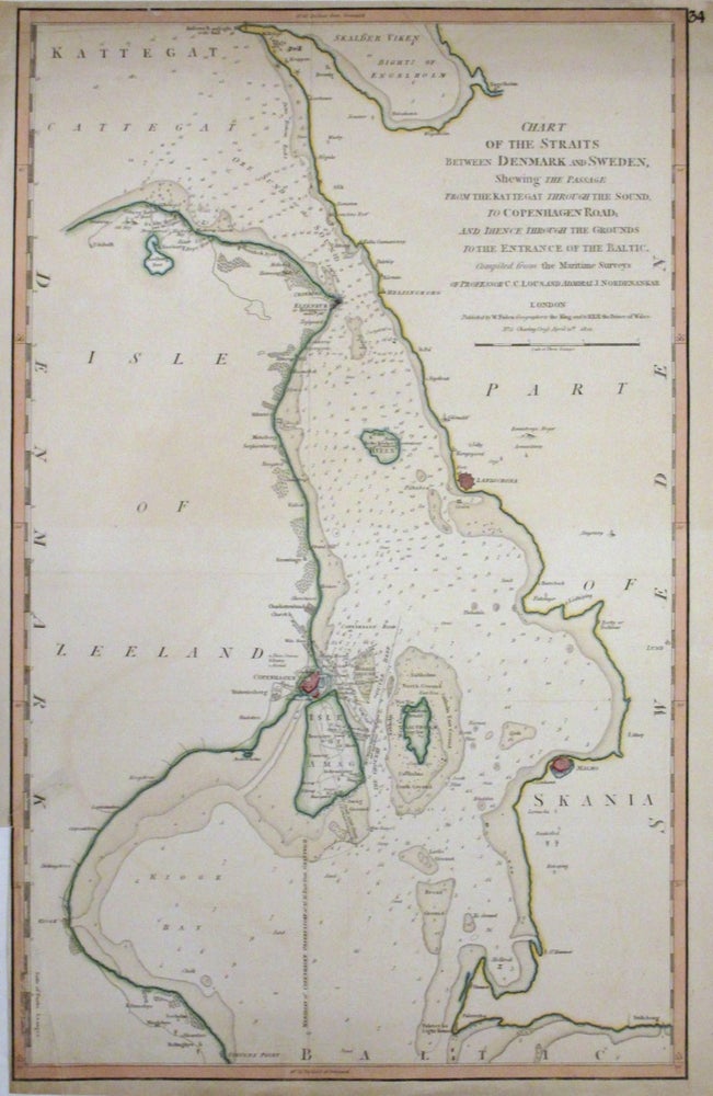
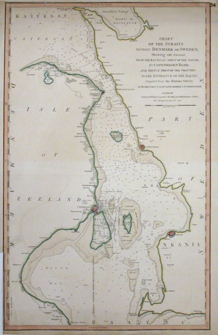
Chart of the Straits between Denmark and Sweden, Shewing the Passage from the Kattegat through the Sound, to Copenhagen Road, and thence through the Grounds to the Entrance of the Baltic
London: William Faden, 1801.
Map. Engraving with hand coloring. Image measures 24"x15 1/4".
This scarce sea chart of the strait between Denmark and Sweden covers the Öresund between the island of Zealand or Sealand and the southern tip of Sweden. The chart notes numerous depth soundings in fathoms as well as coastal features, anchorages, lighthouses, navigational hazards, towns, important roads and other information useful to a mariner. Important cities of Copenhagen, Malmo and Landscrona are identified with important buildings and landmarks in Copenhagen and the Isle of Amag labeled. Today, the Öresund or Øresund Bridge through the Isle of Amag connects Copenhagen in Denmark with Malmo is Sweden. The map is in good condition with some toning and edge wear. Minor wear along the folds. Small tear near the lower left border is repaired on verso. Minor tear in top margin. William Faden (1750-1836) was an 18th century English cartographer, engraver mapseller and publisher and 'Geographer to His Majesty & to his H.R.H. the Prince of Wales, George III & George IV. This is a beautiful example of his work.
Language: English
Price: $350.00
Item #263942