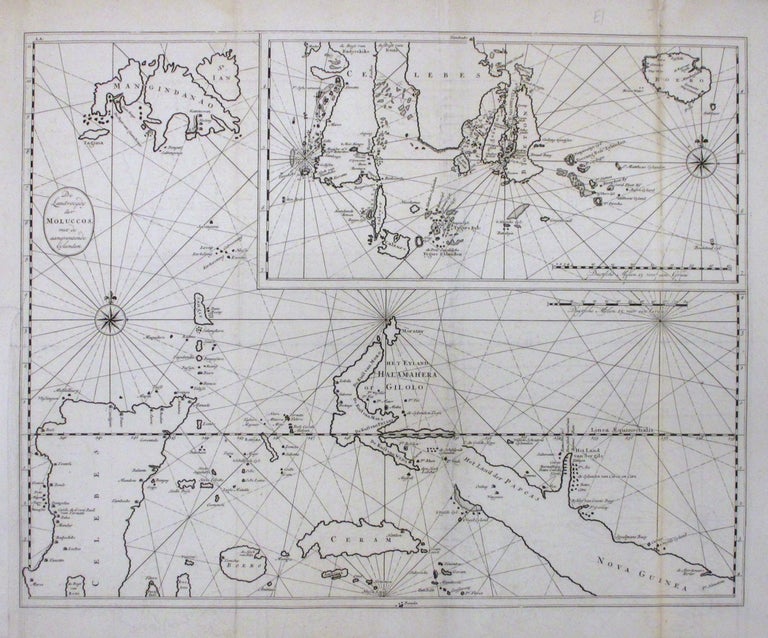
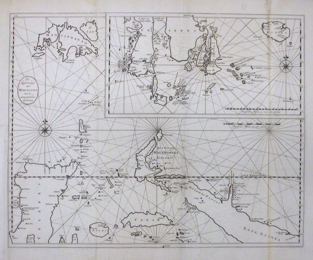
De Landvoogdy der Moluccos
Amsterdam: Francois Valentijn, 1726.
Chart. Uncolored engraving. Image measures 18 x 23".
This rare chart depicts the Moluccas, part of the so-called Spice Islands, otherwise known as the Maluku Islands, in Indonesia. It includes Baru (Boero), Ambon, Seram and part of Maluku (Nova Guinea). Covered largely in mountains and forests, the islands were highly valued by the Dutch as a center for the trade in nutmeg, mace and cloves that were originally found only there. An inset in the top right of the map shows Baru and the southern portions of the Celebes. The map also features rhumb lines and compass rose. It is in very good condition with some offsetting and toning along folds. Some verso repair along folds. A small repaired chip in the top margin, not affecting the image. François Valentijn (1666-1727) was a Dutch minister and naturalist who worked as a missionary in India. He is best known for his "Oud en Nieuw Oost-Indiën," a monumental history and description of the East Indies and its surrounding lands that remains a significant primary source today. This map is a fascinating document of Dutch involvement in the region.
Binding: Unbound
Language: English
Price: $550.00
Item #263437