
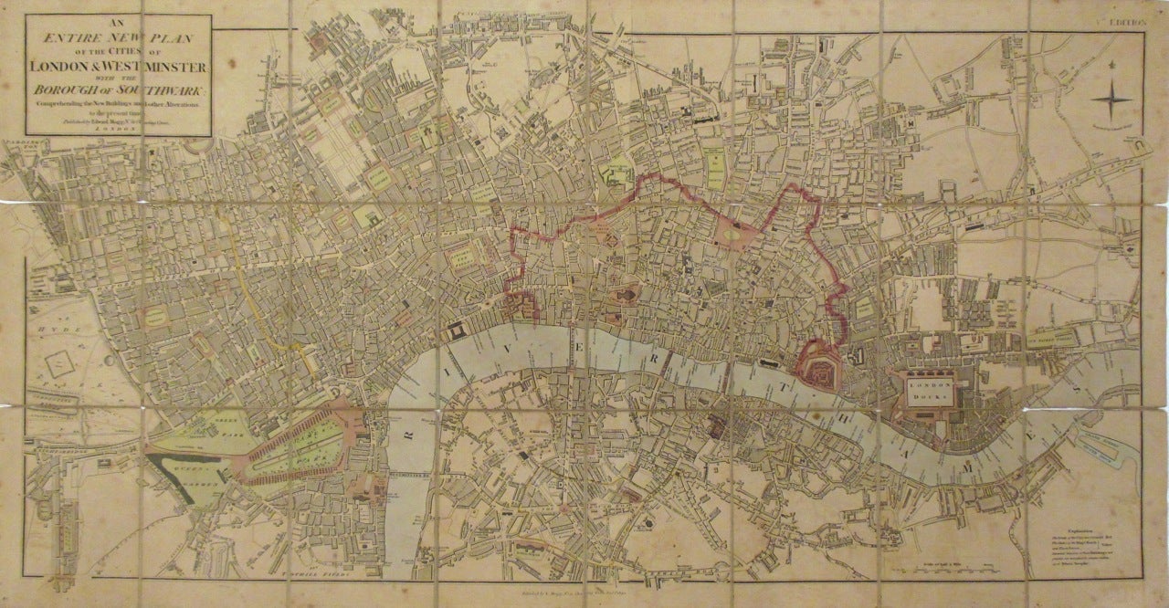
An Entire New Plan of the Cities of London & Westminster with the Borough of Southwark: Comprehending the New Buildings and other Alterations
London: Edward Mogg, 1820.
Map. Pocket map with linen backing. Engraving with hand-coloring. Image measures 17.75" x 35.25". Comes with original slipcase. London: 1820
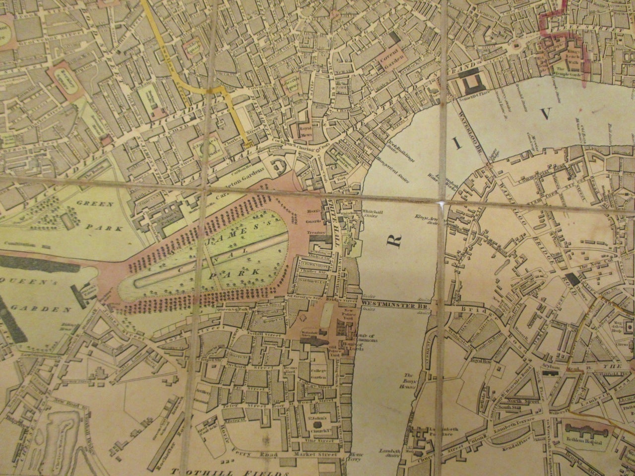
This early pocket map of London shows the city laid out in 1820 around the Thames River, which snakes along the lower half of the map. The city and its surrounding boroughs extend out from the river's shores, with fine engraving of streets and buildings offering detailed insight into the city's development in the early 19th century. Exceptionally detailed, it notes individual streets, parks, important buildings, bridges and docks from Hyde Park east as far as Grand Surrey Outer Dock. Map is in good condition with some wear and splits on linen backing. Overall toning and some stains at places. Edward Mogg was a London publisher, engraver and map seller in the first half of the 19th century. His maps and travel guides to London were famous. He also specialized in road maps road maps of England and Wales. This map is a fine example of his London maps.
Binding: Unbound
Language: English
Price: $1,350.00
Item #262721