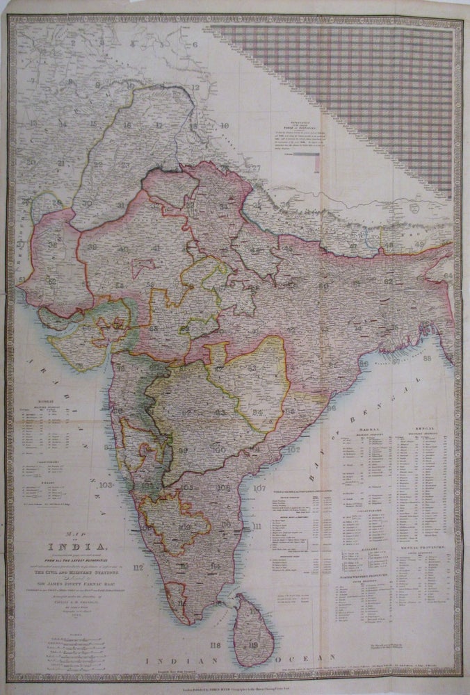
Map of India, constructed with great care and research from all the latest Authorities and intended more particularly to facilitate a reference to the Civil and Military Stations.
James Wyld, 1843.
Map. Engraving with beautiful original hand color. Image measures 37.25" x 26 1/8".
Large and unusual map of the India. Covers the subcontinent including India, Pakistan, Nepal and Sri Lanka. Includes extensive information about the provinces of of Bombay, Madras, Bengal, North Western Provinces and Bengal Provinces pertaining to military stations, collectorates, civil stations. Also includes details about populations and area and an elaborate table of distances. James Wyld Senior (1790-1836) was a distinguished British mapmaker known for producing maps and globes. He served as Geographer to George IV and William IV. Map shows some offsetting. Some verso reinforcements along original folds. Minor spotting and edge wear. This lovely map of is a fine example of his work.
Binding: Unbound
Language: English
Price: $1,100.00
Item #262681