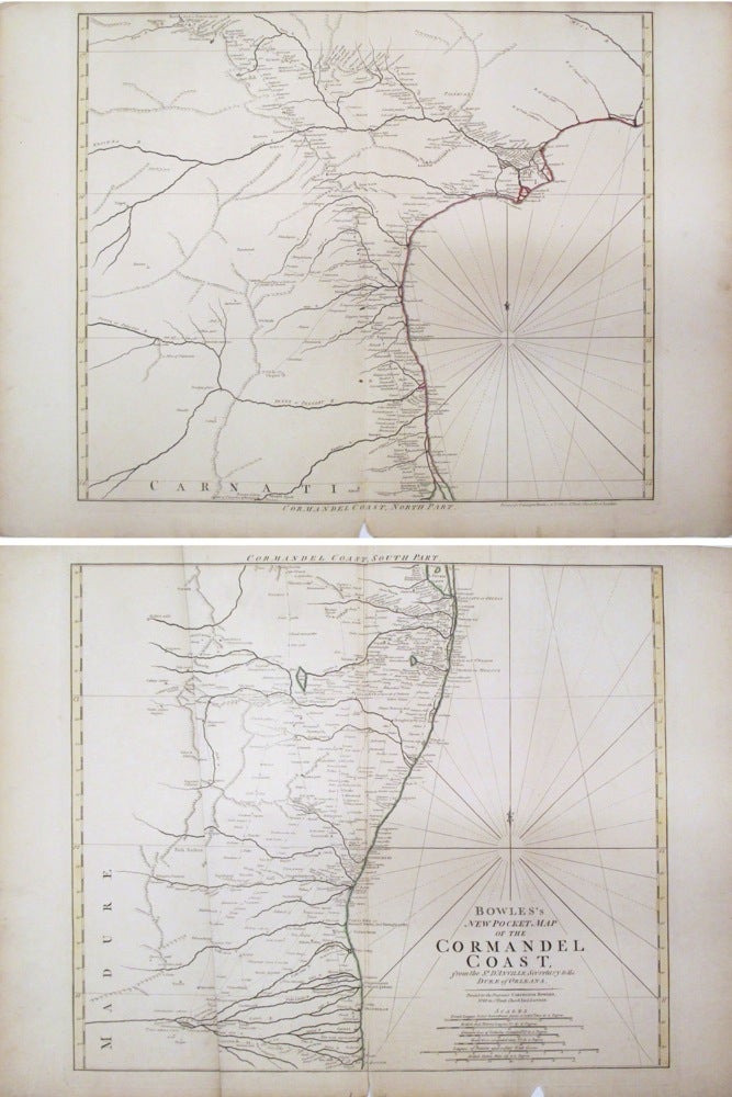
Bowles's New Pocket Map of the Cormandel Coast
London: Bowles, 1794.
Map, in two sheets. Colored outline. Top sheet measures 20 3/4" x 28 3/8", bottom sheet measures 20 3/4" x 27 9/16"
Beautiful set of maps featuring the Coromandel Coast of southeast India from Narsapur south to Nagapattinam. Important cities, rivers, mountains and lakes noted. The Bowles family of publishers and map sellers were active in London for four generations, from the late 17th century to the early 19th century. Carrington Bowles took over the Cornhill bookshop from his father John Bowles. The business would later pass on to his son Henry Carrington Bowles. Centerfold shows some creasing. Ample margins with some aging along edges. Vertical crease on bottom sheet along the height of the map. Small tear to bottom centerfold on both sheets. Minor edge repair.
Binding: Unbound
Language: English
Price: $400.00
Item #262540