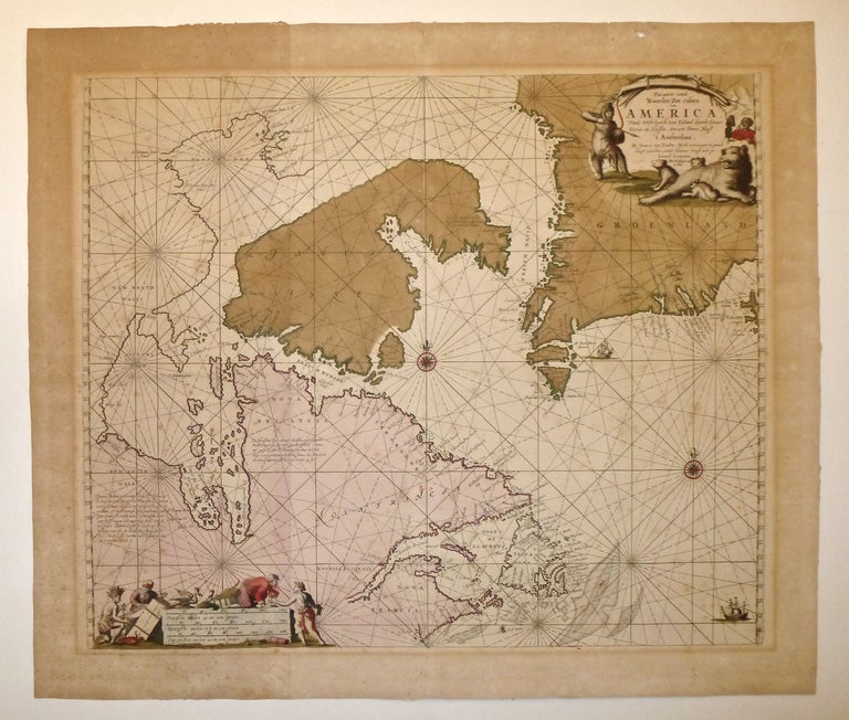
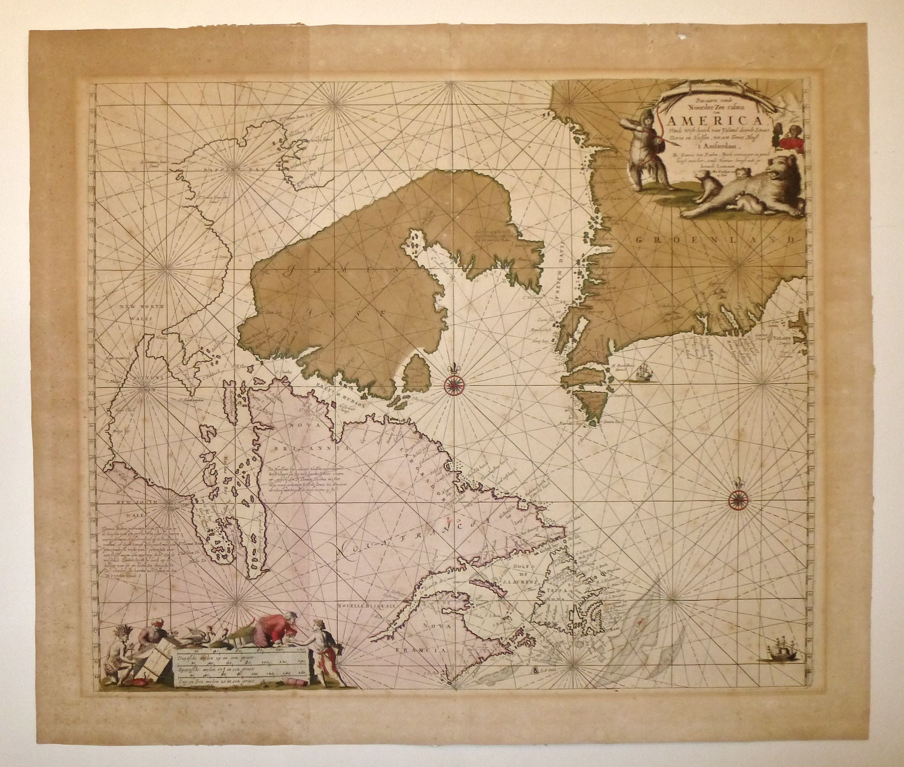
Pascaarte vande Noorder Zee custen van America Vande West-hoeck van Ysland doorde Straet Davis en Hudson, tot aen Terra Neuf.
Amsterdam: 1681.
Sea chart. Copper plate engraving with original hand coloring. Image measures 19.5 x 23.25". Sheet measures 23 x 27".
This wonderful sea chart speaks to 17th-century European interest in the uppermost parts of North America, and particularly Arctic Canada. The map shows the area around the entrance to Hudson Bay and the area of the supposed Northwest Passage. While the interior of most of the land depicted is little explored, the map offers substantial detail on the coasts, with many coastal towns and sea ports labeled. The title cartouche in the upper right corner evidences contemporary European opinions of both Native Americans and wildlife in the region by showing a native and a group of polar bears engaged in a stand-off. The scale in the lower left includes Dutch, Spanish, and English miles and shows a more pleasant image of European and Native American cooperation.The map was published in van Keulen's "Zee-Fakkel." It has ample margins and no chips or tears, although there is considerable mat burn and some color bleed. Fortunately, the deluxe original hand-coloring and sharp engraving gives the map a fine antique look that offsets this discoloration. This is the second state of the map with Newfoundland being mislabeled as Teppa Nova. Johannes van Keulen (1654-1715) was a Dutch cartographer known for his influential nautical and maritime atlases. Based in Amsterdam, he produced books and maps that described travel itineraries and aided in sea navigation.
Binding: Unbound
Language: English
Price: $850.00
Item #247304