![Item #243962 [Case of Large School Maps]. RAND MCNALLY, CO.](https://argosybooks.cdn.bibliopolis.com/pictures/243962.jpg?width=768&height=1000&fit=bounds&auto=webp&v=1375459883)
![[Case of Large School Maps]](https://argosybooks.cdn.bibliopolis.com/pictures/243962b.jpg?auto=webp&v=1568393779)
![[Case of Large School Maps]](https://argosybooks.cdn.bibliopolis.com/pictures/243962c.jpg?auto=webp&v=1568393779)
![[Case of Large School Maps]](https://argosybooks.cdn.bibliopolis.com/pictures/243962d.jpg?auto=webp&v=1568393779)
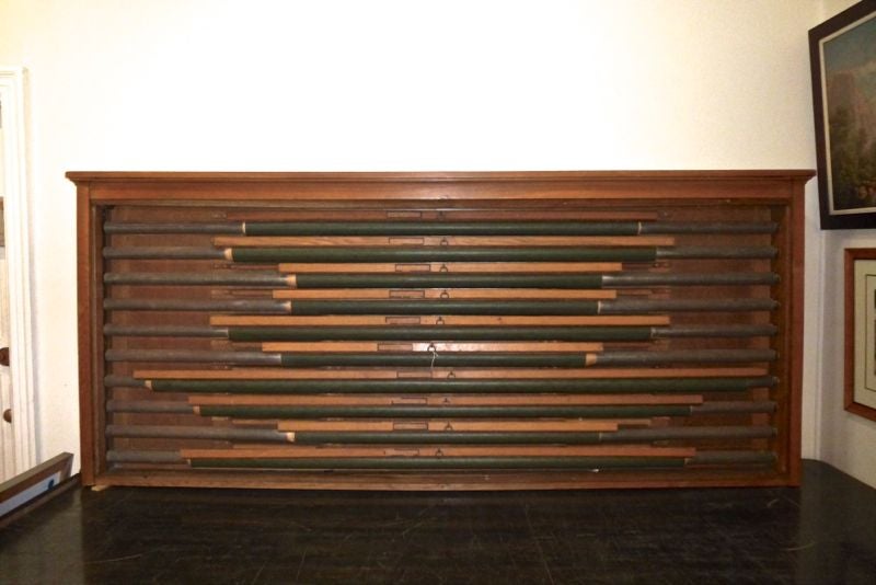
[Case of Large School Maps]
Case of 9 maps and 1 projector screen. Oak case with tambour roll top. Case measures 40 x 92 x 10".
This original oak case contains 9 oversize school maps dating between approximately 1930 and 1965, as well as one projector screen. The collection was deaccessioned from Cornell University and contains a range of political, commercial and ecological maps. The case has a built-in tambour roll top and is designed to be mounted to the wall. Maps include: "Natural Land-Use Areas of the United States," U.S. Department of Agriculture; "New York," Rand McNally & Co; "South America," Rand McNally & Co; "Europe," Rand McNally & Co; "United States," Rand McNally & Co, Political Wall Map Series by J. Paul Goode; "Asia,"Ranally Political Series; "Double Hemisphere World Map," Rand McNally & Co; "Trading Center and Distribution Map of the United States," Rand McNally & Co; and "North America," Rand McNally & Co. Some maps have discoloration from roll mechanism. World map is fraying in center.
Language: English
Price: $1,650.00
Item #243962